Oregon Alone: The 2016 Oregon Outback
I’d already scripted the lede for this blog before I got off the train to start the ride in Klamath Falls. Goddammit Donnie!* I’d shout into the dark, as I fumbled for tools, alone, patching a flat tire 20 miles down the OC&E Woods Line Trail. He can’t cancel the ride! He gave it up!
You see, I wanted to relive the magic of all those bros thundering across the prairie the last two years. I assumed that when the Outback was cancelled, it was more of a “nod, nod, wink wink, it’s ‘cancelled’” type of thing. But as the date approached, it became clear that no one was doing it. I felt like an idiot riding a train down to Klamath Falls by myself to go balls to the wall on the Outback without that spark from 100 other people moving down the same trail.
Not a hapless idiot—my plan was sound, and I knew what I was getting myself into. I intended to ride 450 miles in three days, riding the Oregon Outback route for 300 miles to Shaniko, then turning left and riding the Barlow Road around the side of Mount Hood and back to Portland. I’d ride 32 miles into the night straight off the train to get a jump on the ride, then I’d ride from 8 a.m. to 11 p.m. Saturday, Sunday and Monday—going into work Tuesday a barren husk of a man.
I guess I felt like more of a “weirdo” than an idiot—an “outsider,” not “with it,” “didn’t get the memo.”
Why am I the only person in Oregon who still wants to ride the Outback? I wondered. Do people only do shit if it’ll get them on some famous person’s Instagram nowadays? Is bikepacking “over” two years after it “started” for everyone in Portland?
Was the Oregon Outback dead? And I a lonely necromancer?
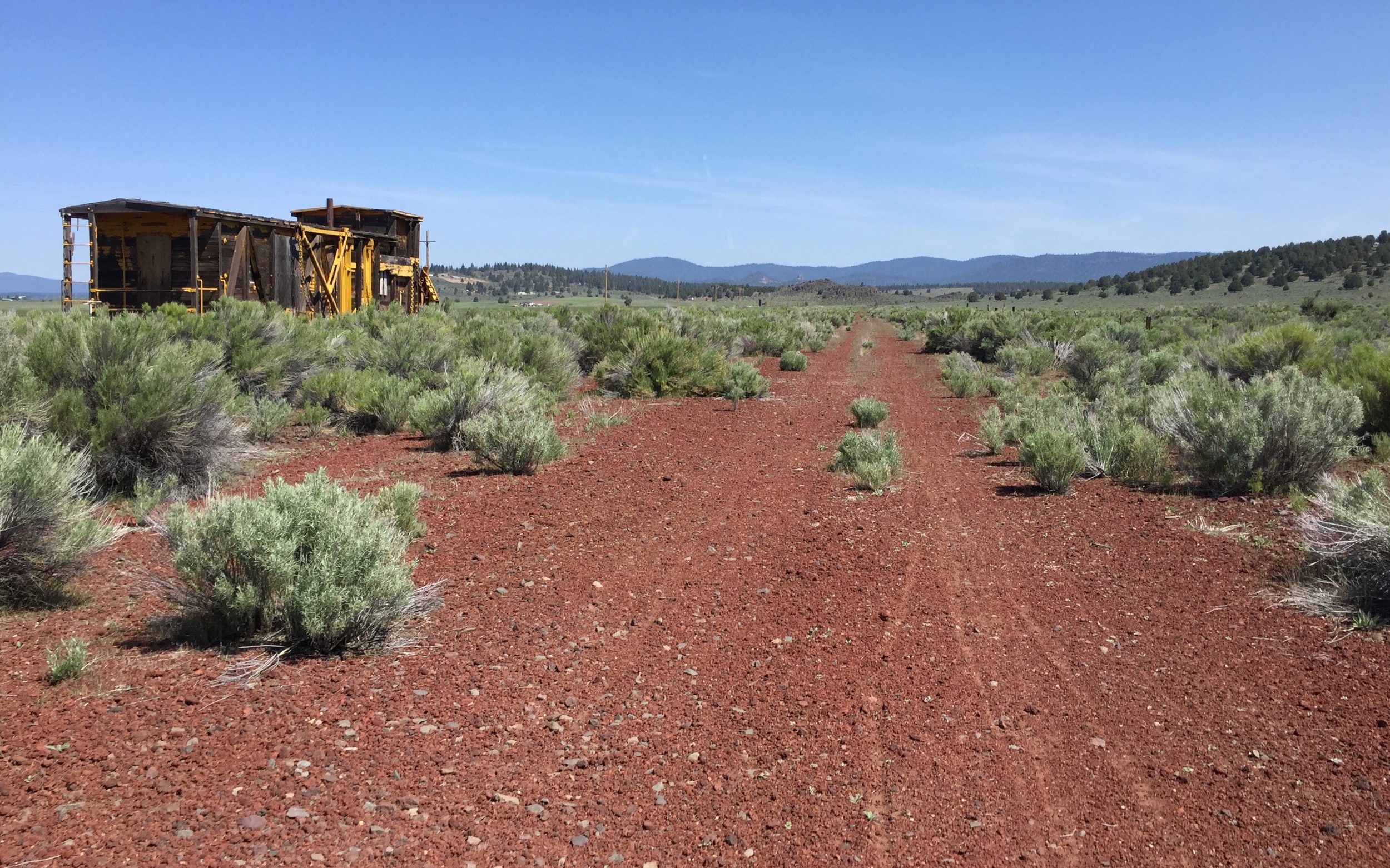
But when I finally got out there, about 11:30 at night, past the abandoned snow plough train that marks the beginning of a 70-mile pumice track through the middle of nowhere, I didn’t feel mad or bitter at all! I felt excited and giddy to be out there in the middle of the night by myself.
What a wild idea, right?
I was on the right track.
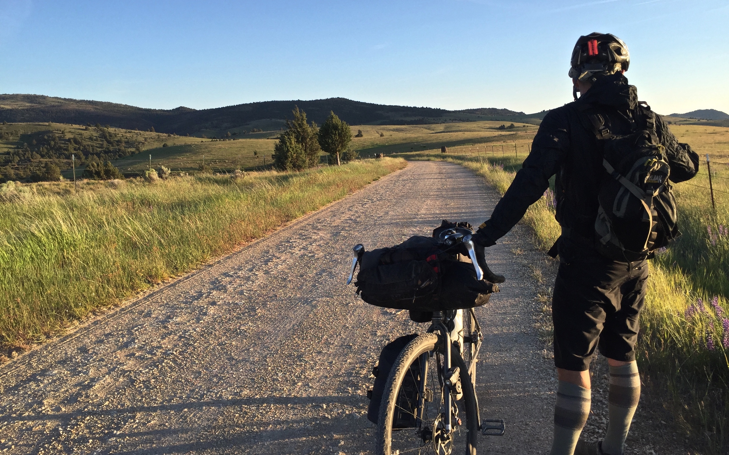
DAY 0 / Miles 0-32: RIDING THROUGH THE NIGHT, IT’S CHEAPER THAN A ROOM AT THE MAVERICK
I remember reading somewhere that Edward Abbey was actually with his wife during parts of Desert Solitaire. I’m not sure if it's true. But I don’t think such an artistic license is justified for the sake of this mediocre blog post’s narrative.
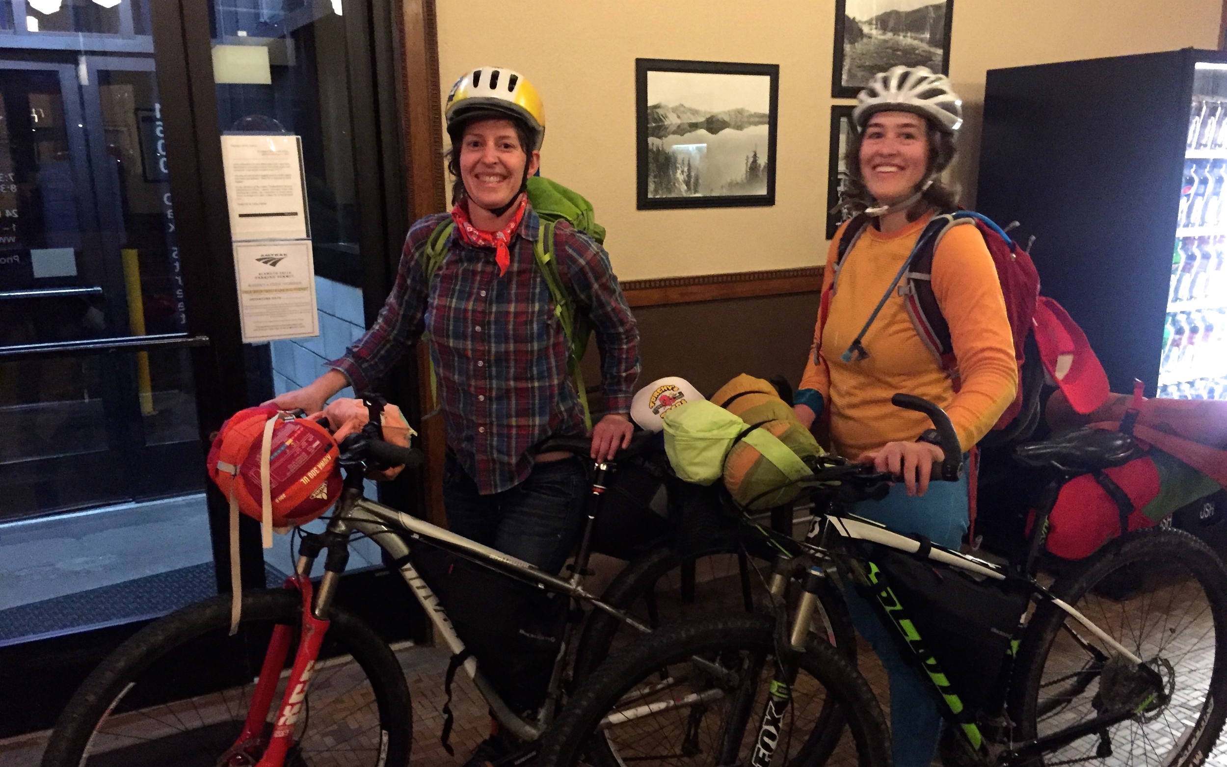
I wasn’t exactly alone on the train. When I got to the train station in Portland, there were two girls waiting to box up their bikes, just as I was. They were heading to Klamath Falls to ride the Oregon Outback also. They were staying at the Maverick and starting the next morning. It was their first time, and we talked about the route on the train a bit. I told them a few things, but couldn’t think of much that seemed crucial. They had their GPS routes and their maps, and seven days to ride. They’d be fine.
[They made a really cute video after they finished and posted it on Facebook. I’ll link it here after my Facebook hiatus ends]
The train ride took forever with no wifi, no books, and no car entirely filled with people I knew. I hung out in the observation car most of the way (the party car), had a couple of random conversations, and watched the now-familiar scenery of the Cascades: mostly a never-ending row of Douglas Firs rolling by.
I signed up for the last dinner slot on the dining car, and had a great conversation with the three other solo passengers randomly assigned to my table—all men who seemed better-educated and more successful than just about everyone in the party car. I was struck dumb when all three agreed immediately that Bernie Sanders seemed like a wildly radical presidential candidate. Not what you hear around Portland. But I held my tongue, not wanting to get too far off the topics of travel, adventure and everyone’s jobs that we’d been discussing so far.
I changed into my spandex in the cramped bathroom just before we arrived in Klamath Falls, eager to to waste no time and get straight into “tour mode” immediately off the train.
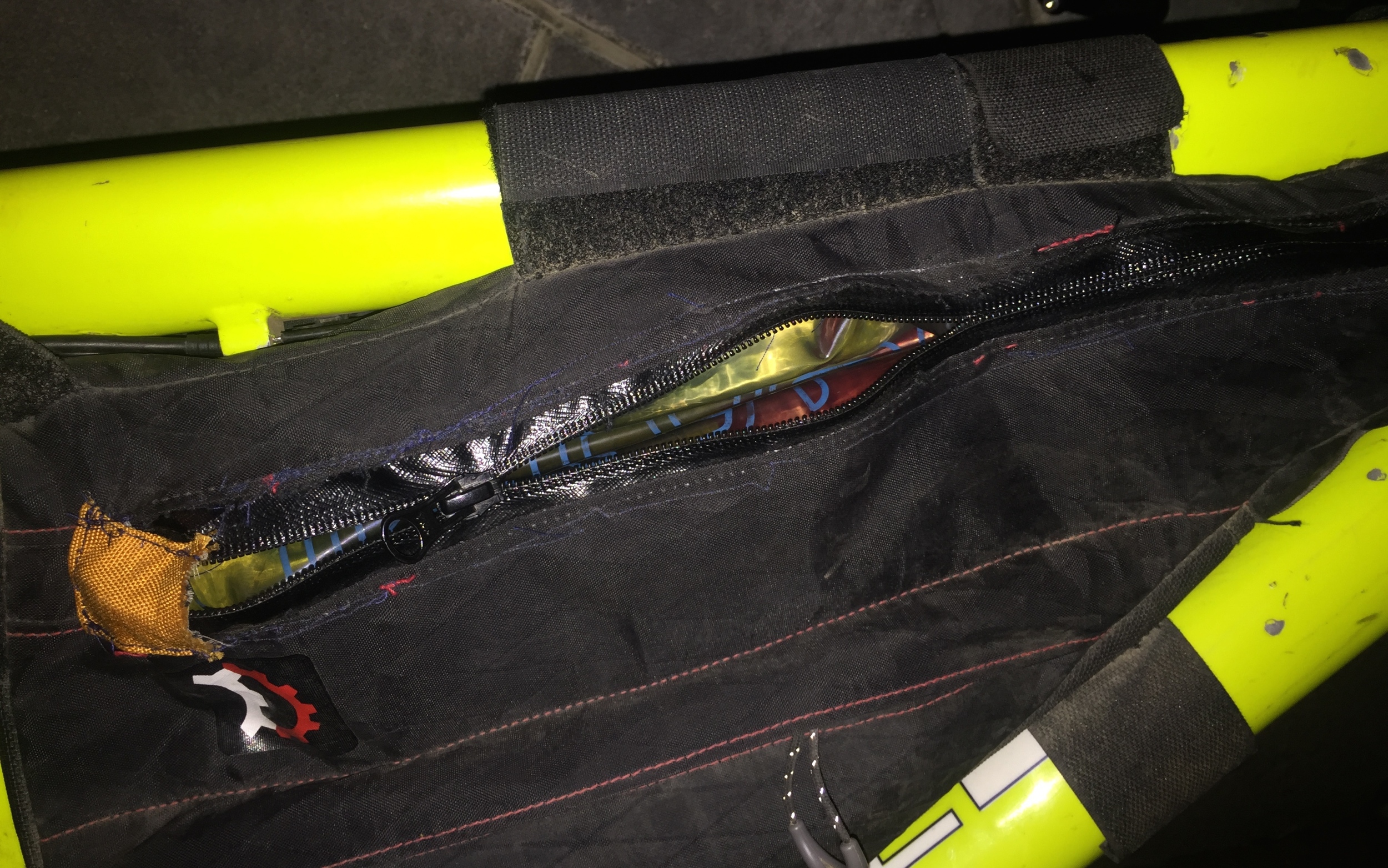
We deboarded in Klamath Falls, and the always-friendly staff carted our bike boxes over and gave us permission to assemble them in the tiny train station. Me and the two other gals turned our handlebars straight, screwed on our pedals, strapped on our lights, filled up our water bladders, etc, then took a commemorative photo. We wished each other well and I went out into the night to promptly break the newly-repaired zipper on my frame bag.
Well shit, I’ll have to get some safety pins.
It was 10:30. I wasn’t about to stick around for a broken zipper. I rode toward the trail looking for somewhere to “donate” the old jeans I’d worn on the train, and hung them on the rail of the Klamath Open Door Family practice, an old client of a client that I knew served a lot of low-income residents in the area. Hopefully they could use them and I wasn’t just littering.
I hit the level concrete of the OC&E Woods Line Trail, the beginning of a 110-mile rails-to trail (Oregon’s longest), and listened to the faraway sounds of truck stereos and drunk people laughing at the small-town party spots that dotted the sagebrush prairie on the edges of town.
A breezy tailwind blew me the first nine miles at 15 mph—fast enough for my dynamo hub to light the way and charge my phone that was dead from too much attempted internetting on the train.
I hit the real OC&E trail within 45 minutes, and enjoyed the sound of my own tires crunching along over a bed of pumice gravel. I moved swiftly, aided by fresh legs and the tail wind, despite the slight incline and the deteriorating surface conditions. The cattle gates were popping up more frequently, and they frustrated me much more than the previous years, when you could just kinda close the gate, knowing another rider was a few hundred yards behind. I did my due diligence at each gate, unraveling the chain that locked it, determining which kind of latch closed it, swinging it open with a huge rusty, spring-loaded creak, then closing and latching it before moving along.
Noises in the dark take on much greater significance when they lack any corresponding visual data. I heard something like a swishy rattlesnake call to my exact left. As I kept riding, the sound remained directly to my left. I stopped, thinking it must be a flat tire echoing off the fence, but it was clearly coming from beyond the fence. It must have been one of those gigantic irrigation sprinklers on wheels that run for half a mile and move on their own motors because I rode next to the sound for minutes.
I started running into frightened cows along the trail, lumbering scared from my bizarre headlight that rolled toward them. During the most densely-gated section, I rolled straight up to a massive steer standing firm in the middle of the trail. He looked right at me and did that bull snort that they use in movies that signals that a bull is about to charge you. He didn’t charge, so I did instead—creeping toward him until he backed away, then starting loped off into the night.
Jesus Christ!
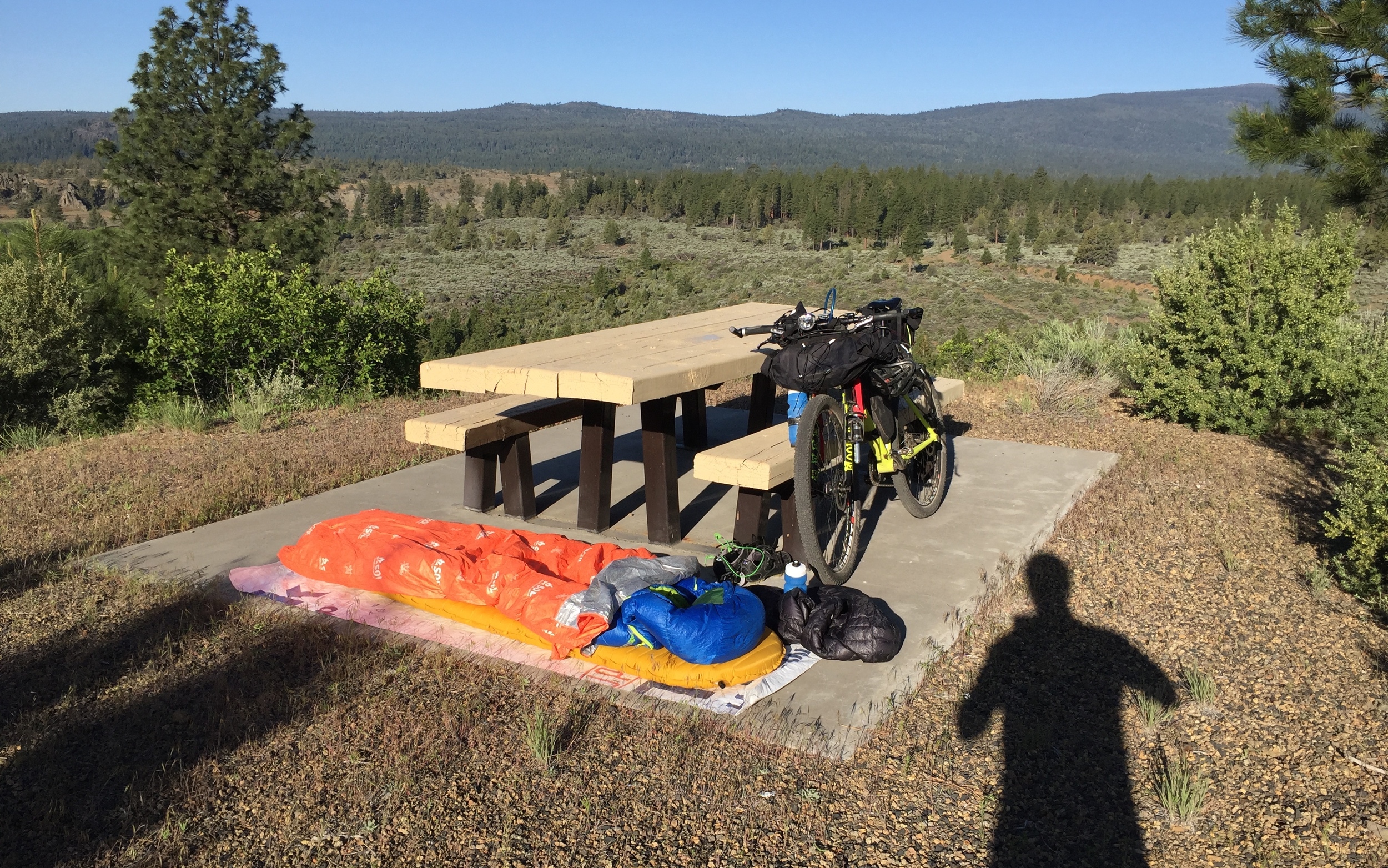
After a couple hours of spirited riding, staring at my Garmin, and endlessly calculating how long until I’d get there, I made it to my campsite: the trailhead at Bliss Road, living up to its name with amenities such as a surprisingly warm pit toilet and three picnic tables with concrete slabs that I could sleep on, sound in the knowledge that I hadn’t set up camp on top of a rattlesnake’s hole.
It was pretty damn cold up at the top of the hill at 5,000 feet—probably in the high 30s—and I briefly entertained the idea of sleeping in the outhouse. My dignity got the better of me, and I slept outside with all my clothes on. In bed on Friday night by 2 a.m.
DAY 1 / Mi. 32-165: FORT ROCK BY SUNSET OR BUST
When I woke up to pee at 5 a.m., it had already warmed significantly—a good sign. I woke up again at 7 to find that I’d taken off my super-hyper-ultralight puffy coat and thrown it next to my sleeping bag. Luckily there was no wind to blow it away.
I packed up and hit the road at 8:07 a.m., seven minutes behind schedule, and rode the few miles to Sprague River where I knew there was a deli with sandwiches and coffee.
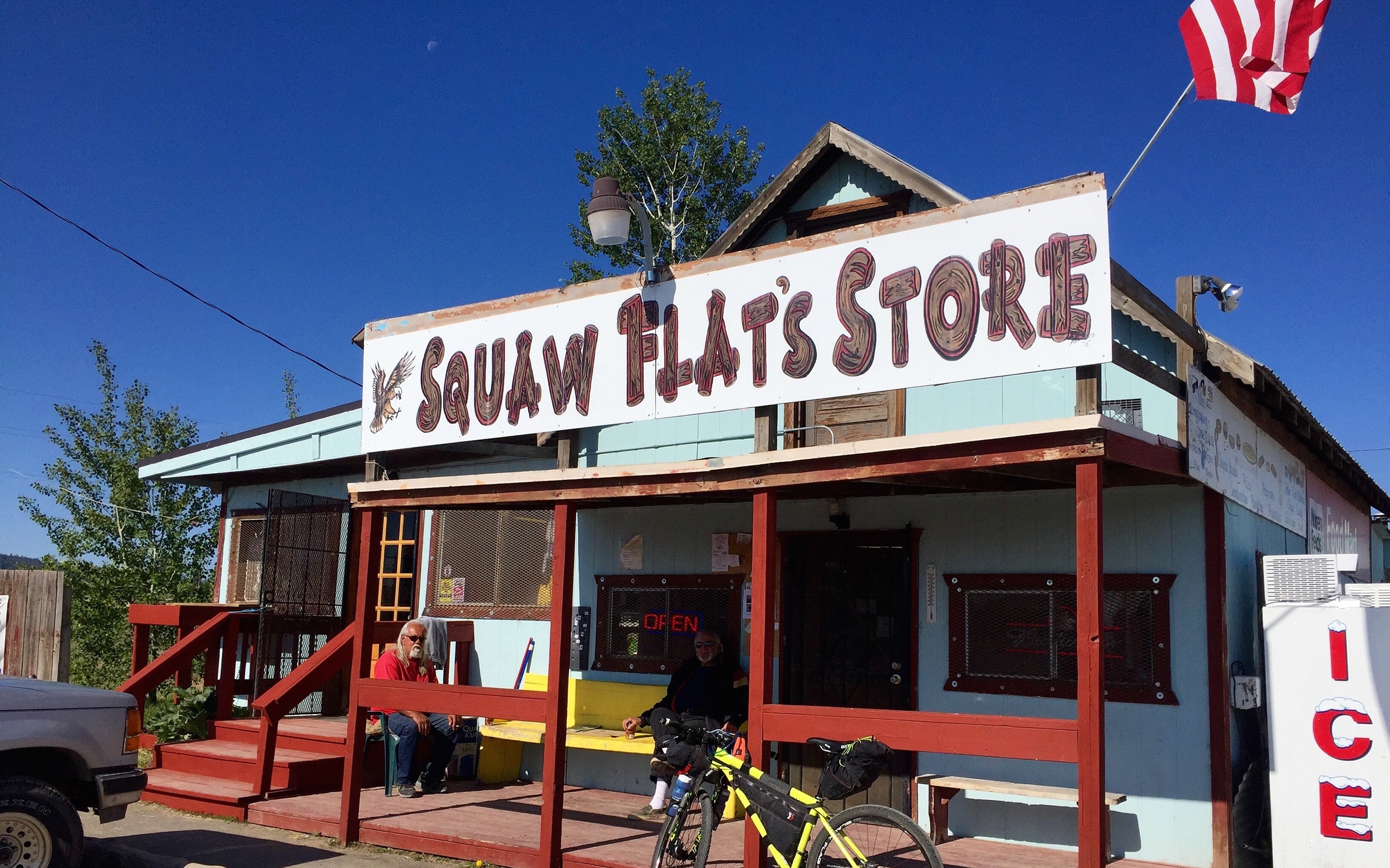
The deli was closed when I got there. Their hours said 10-6 and I couldn’t wait that long. So I went to the sun-beaten Squaw Flat General Store down the street, with a group of similarly sun-beaten oldtimers smoking cigarettes and drinking coffee out front.
“Howdy, Gentlemen,” I said. They nodded.
I poked around the store for several minutes trying to piece together some type substitute breakfast. I settled on a salami sandwich with mayonnaise (I hate mayonnaise), two beef jerky sticks and two bananas. And of course shitty coffee.
I drank my shitty coffee with three of the oldtimers on the front porch, and took two revolting bites of the salami sandwich, before wrapping it up and putting it in my bag.
“Where you comin from?” one guy asked.
“I started in Klamath Falls, but I was camped out on the OC&E Trail by Bliss Road last night.”
“Bliss Road… used to be Squaw Flat, but then the natives made ‘em change it. Buncha bullshit if you ask me.”
There was a cute but very skittish, nearly-grown puppy slinking around, begging for food.
Her fat, redneck owner, got up to leave and yelled at her to follow, but she wouldn’t listen.
“OK, get it in the car.” She slinked off. “YOU GET IN THE CAR! GET IN! COME ON!”
The fat redneck and the other two guys slowly chased her around, each lacking the agility to really even bend over, so I came around from the side, grabbed the dog, and handed her over to her owner.
“You little piece of shit,” he said. He punched her on the head like four times.
I felt ashamed that I didn’t say or do anything. It wasn’t my battle to fight, right? This was their world. I got on my bike and got the fuck out of it.
By the time I rode back by the deli, it was already open—30 minutes early. I had to get some real food.
“You’re open early!” I said, after greeting the man behind the counter.
“Yes, I thought ‘what the heck I have work to do anyway.’”
“Well lucky me.”
“Are you out doing the Outback?” he asked.
“Yep. Started last night and camped out by the Bliss Road trailhead.”
“We had a couple people through yesterday, and then a few last weekend.”
“Yeah, I hear there are a few out here this year. I guess they cancelled the official ride.”
He’d heard all about it, including the mythical turd outside the barn—didn’t seem too concerned one way or the other. I ate half of my very good machaca burrito, then talked to the owner a little more about his time working for a Mexican restaurant during college, about his career as an engineer before he retired, about the younger gal from Sprague River who was supposed to run the deli before she moved on to the city.
“Well it keeps me busy,” he said.
The guy was about the nicest dude in Oregon, but I couldn’t spend any more time with him. it was past 10 a.m and I’d only ridden 7 miles of 132 for the day.
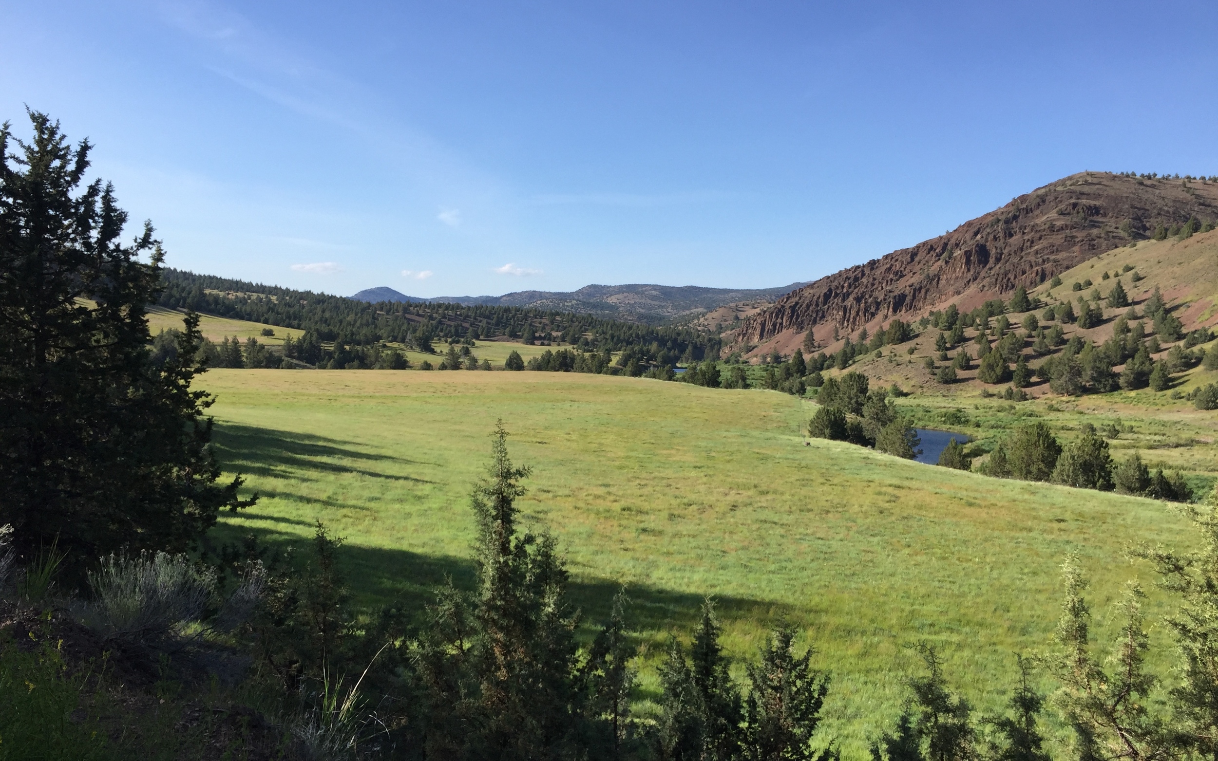
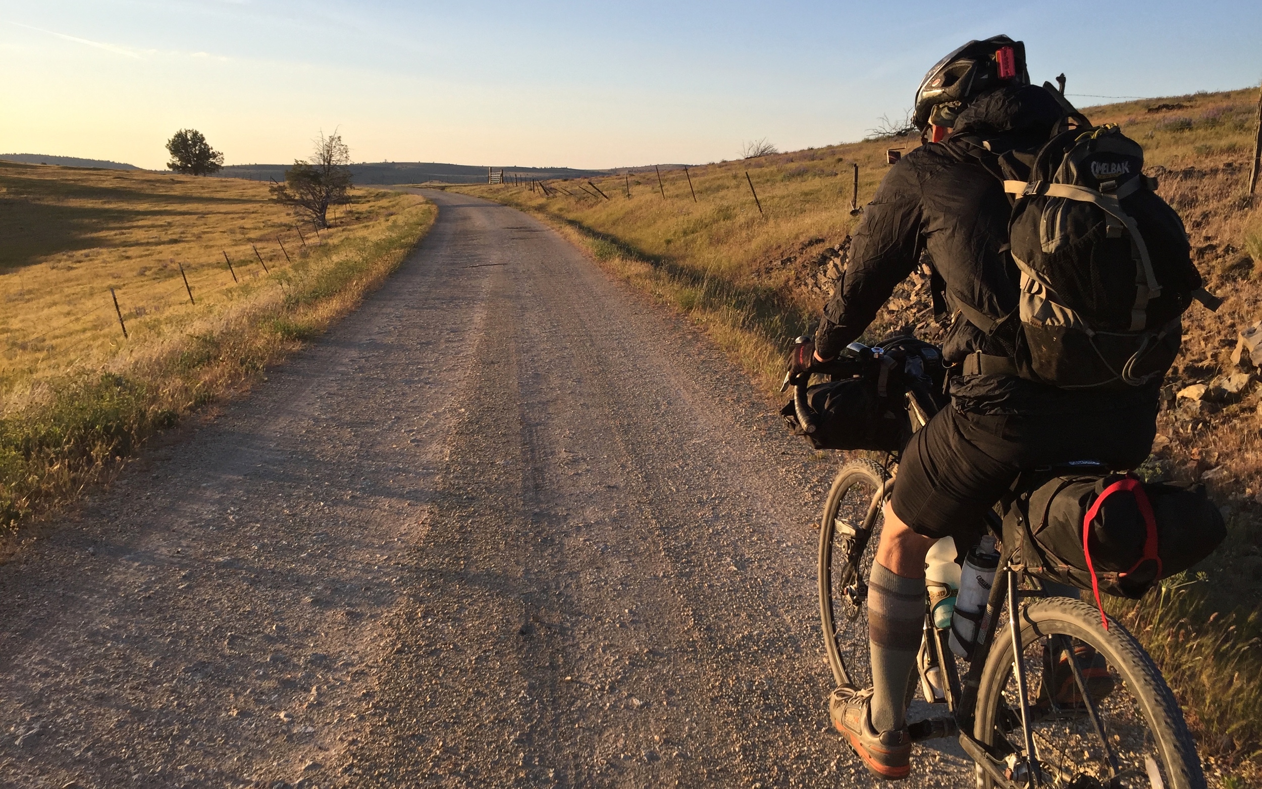
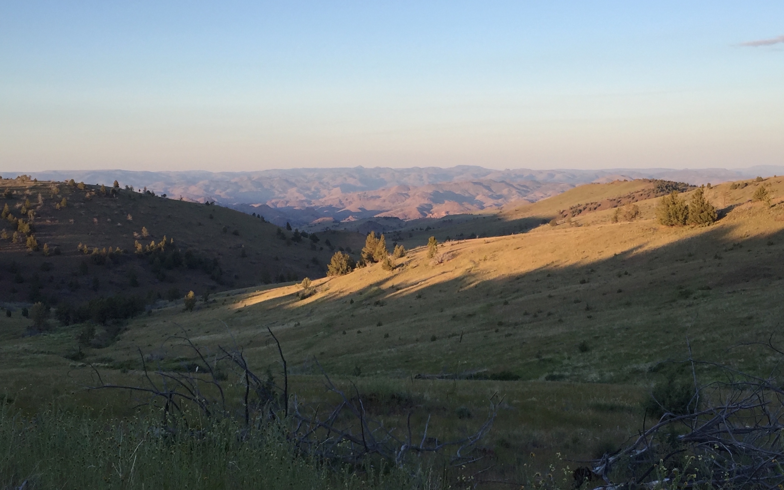
The flat, marshy zone along the Sprague River is one of the most unique climates on the route. There are 1 million birds and almost as many cows. The route alternates between crushed pumice and doubletrack ranch driveways. And speaking of turds, there are also 1 million cowpies. Sometimes it’s tough to judge whether they’re “rideable” (hard and dried out) or not, until they squish...
Out of the corner of my eye, I saw one of two massive birds flap aggressively, then fly at a coyote on the periphery of a meadow. The coyote ran into the bushes, and I saw why the bird was so bold: there was a fuzzy, baby blue heron in the meadow with them that it was protecting.
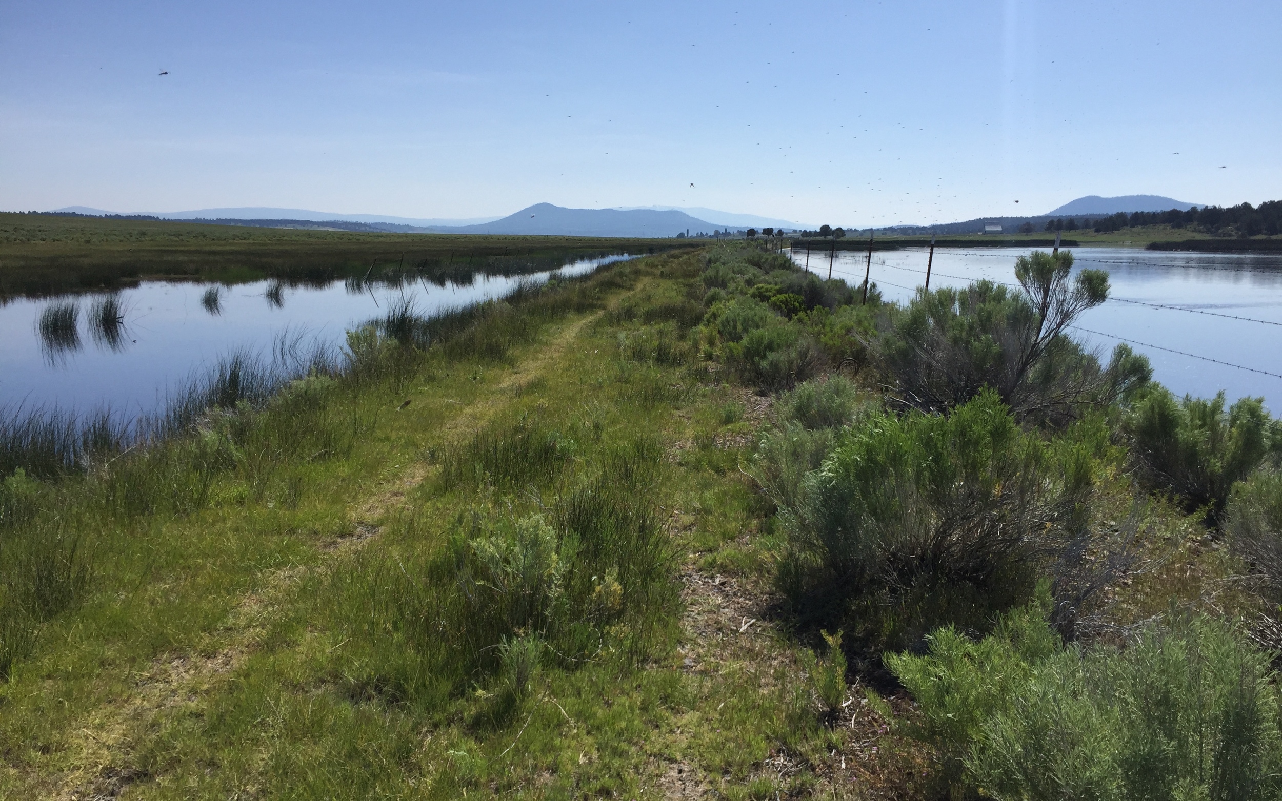
After another hundred gates, the trail bends left, departing the Sprague River with its final crossing, and heads gently uphill, back into the woods, along the idyllic Fivemile Creek. One day, I’ll take this route easy so I can camp along this beautiful stretch, but not today.
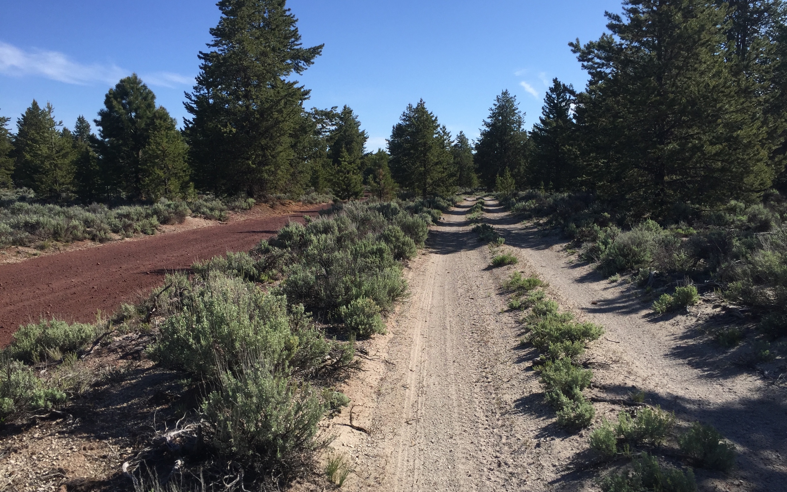
I’d only made it 30 miles by noon, and I had 108 to go before bed. The OC&E’s pumice gravel got worse and worse until it was loud, chunky and slow. My pace stayed below 10 mph and I watched the red light for my dynamo USB charger turn on and off as I dipped above and below the approximate 8 mph charging threshold.
I kept pulling my phone out and looking at the pre-loaded RideWithGPS track and see if I was any closer to the road. I was barely moving.
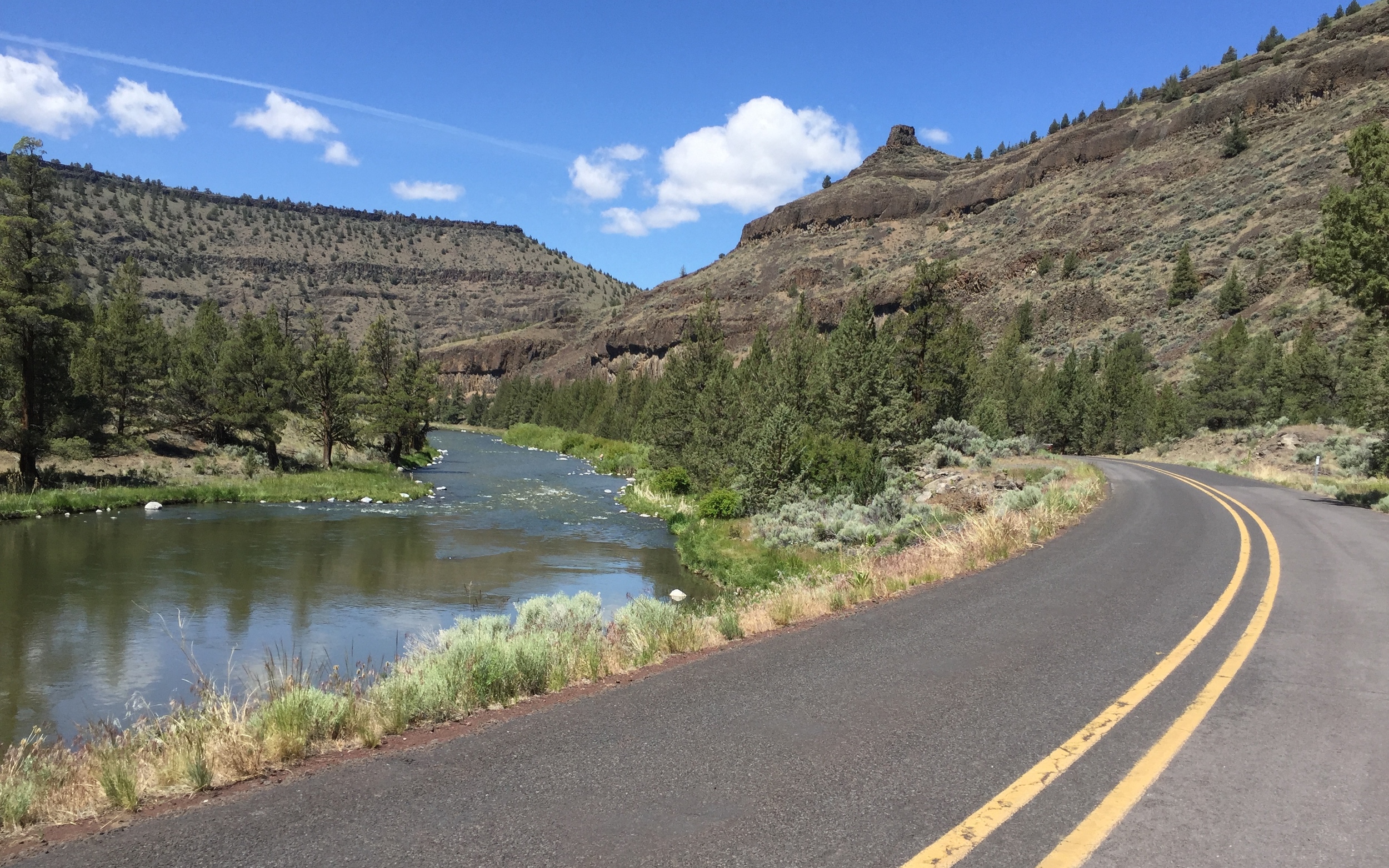
I finally made it to the road! A merciful cross-tailwind blew into my side as I floated back above 5,000 feet for the 40-mile paved/gravel road segment into Silverlake. Miles of spaced-out, East-of-the-Cascades forest with sagebrush went by.
I got a flat—bad enough that I had to patch my tire with some Tenacious Tape. I decided to make up the lost time by skipping the red gravel road that goes by the Cowboy Dinner Tree and just shoot straight into Silverlake on the paved road, chasing cows off the road at my top cruising speed of 15 mph.
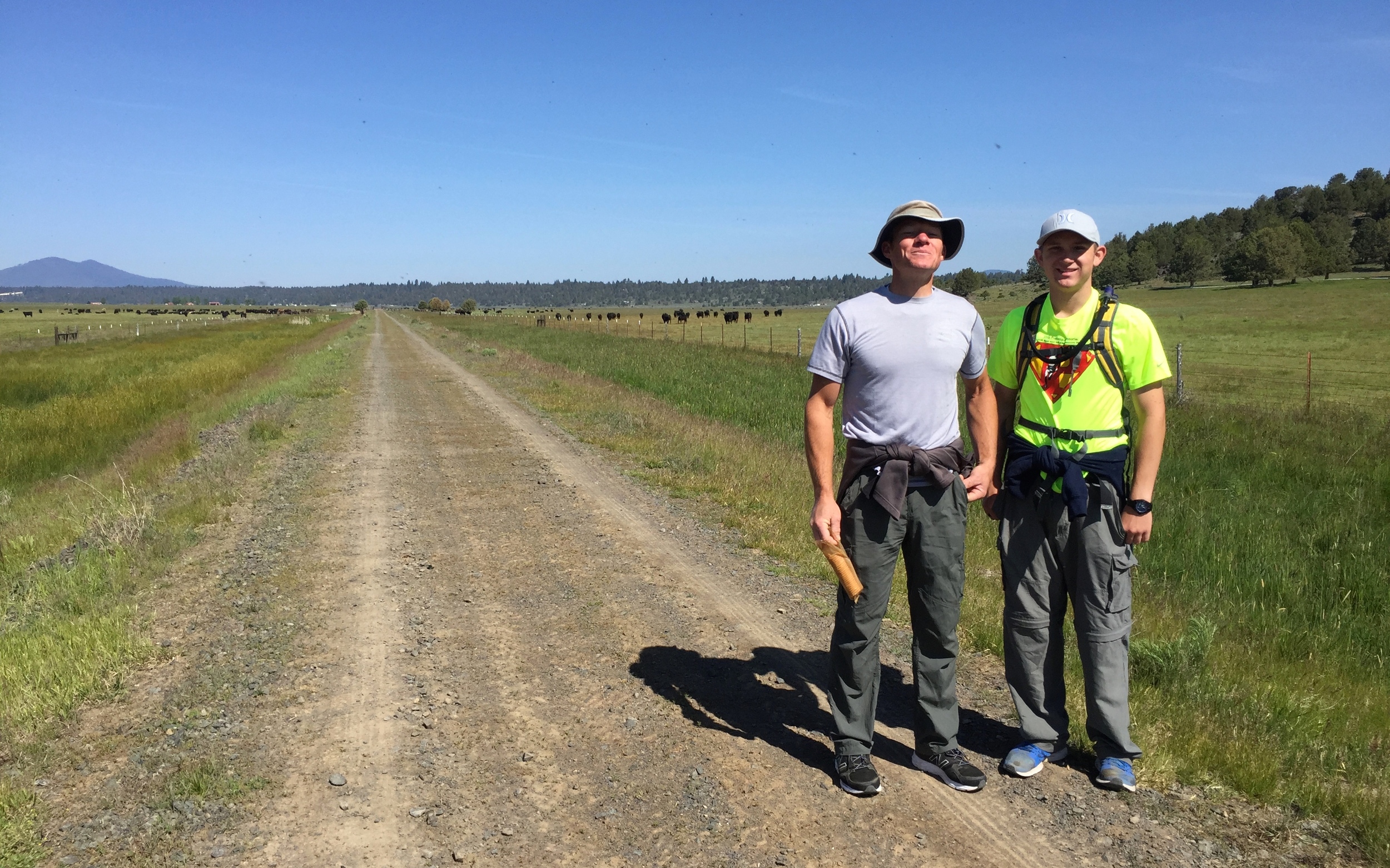
I made it to town at 5 p.m. and hit the general store to get enough food to make in to Prineville the next day. A few minutes later, some kids in bike gear walked in. They were doing the Oregon Outback!
Ally from Allybama, Scott from Texas, and Johnny from New York greeted me and told me about the two days of riding that they’d done to get there, including a ride in a car from some friendly locals to Klamath Falls and back for a tube (apparently Johnny came prepared to camp for seven days, but forgot to bring a tube).
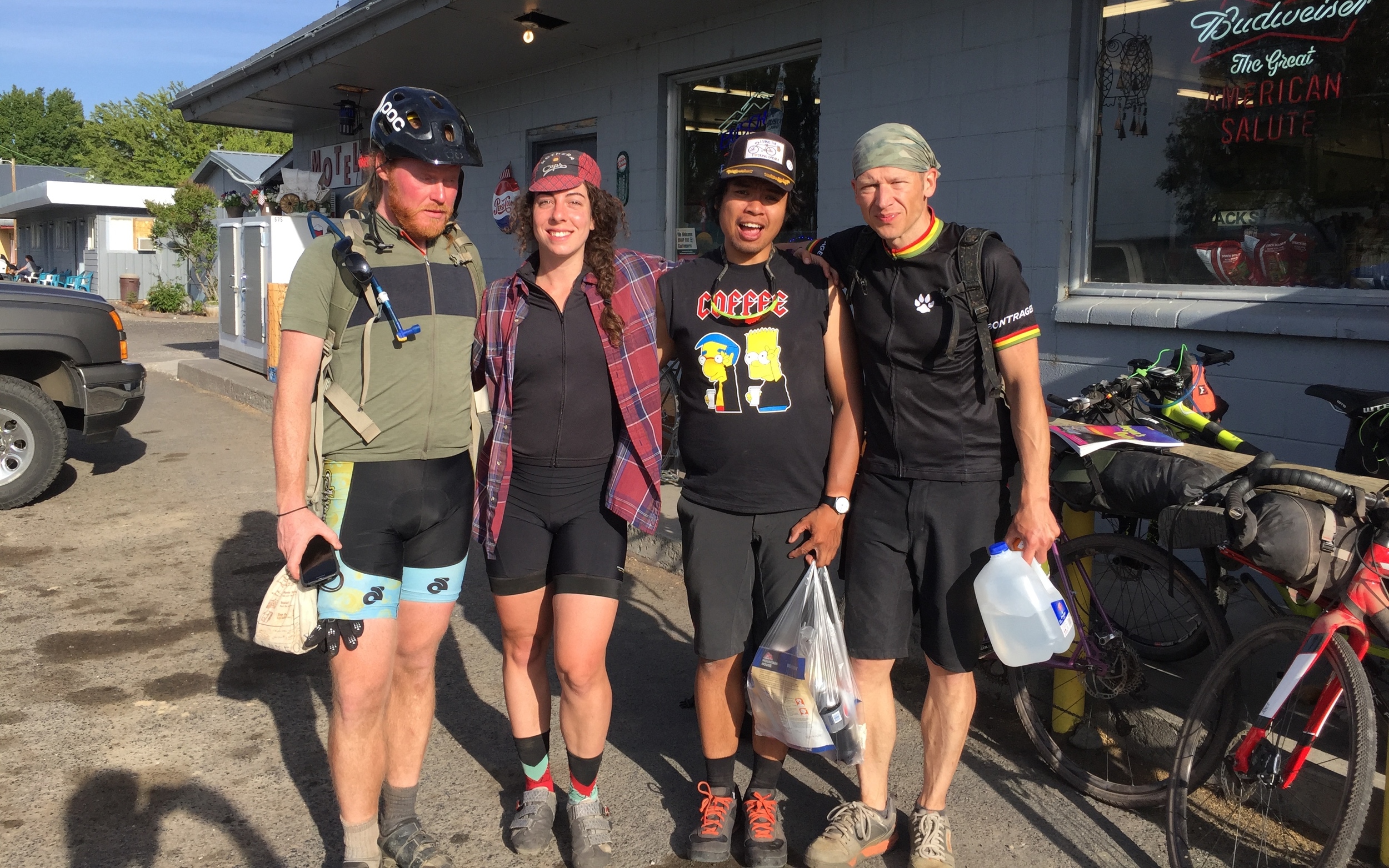
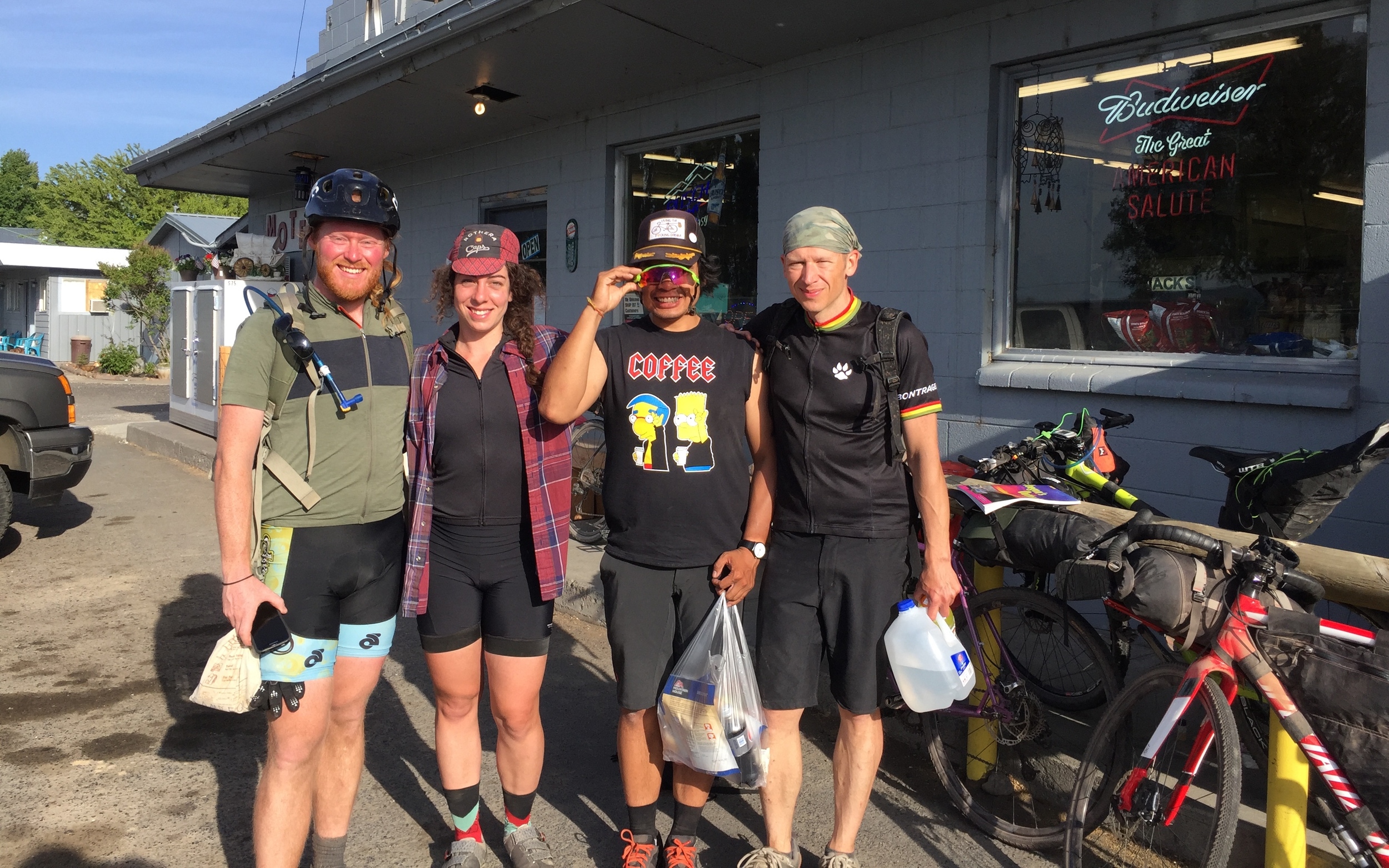
We bought chips, hot dogs, bananas, cheese, everything. They got set up with a campsite in the store owner’s yard. I explained that I still had 50 miles to ride before I could camp. As we were hanging out front eating, another guy showed up on his bike: Eric from Portland. Eric had started at 6:45 that morning in Klamath Falls, but planned to camp in Silver Lake also, so the trio invited him to share their campsite.
He was curious about my plan, though. “How far until the Deschutes National Forest? How long do you think it’ll take?”
“Well, it’s only about 30 or 35 miles to the national forest, and you can camp anywhere you want once you get there.”
“How fast do you think you’ll be riding?”
“Like 10 or 12 miles per hour? You already rode 120 today, so I’m sure you can keep up.”
Just as I was jumping on my bike, he made the call.
“I think I’ll ride out with you.”
The store owner told us that we should stay there—it was too wild in the national forest with drunk people and guns and quads. I told him I’d done this exact same thing on the exact same weekend the year before.
“This isn’t like last year. I’ve never seen it like this before. It’s crazy up there right now—tons of people on four-wheelers.”
We politely thanked him for his advice, and went on, hoping to catch Fort Rock before sunset.
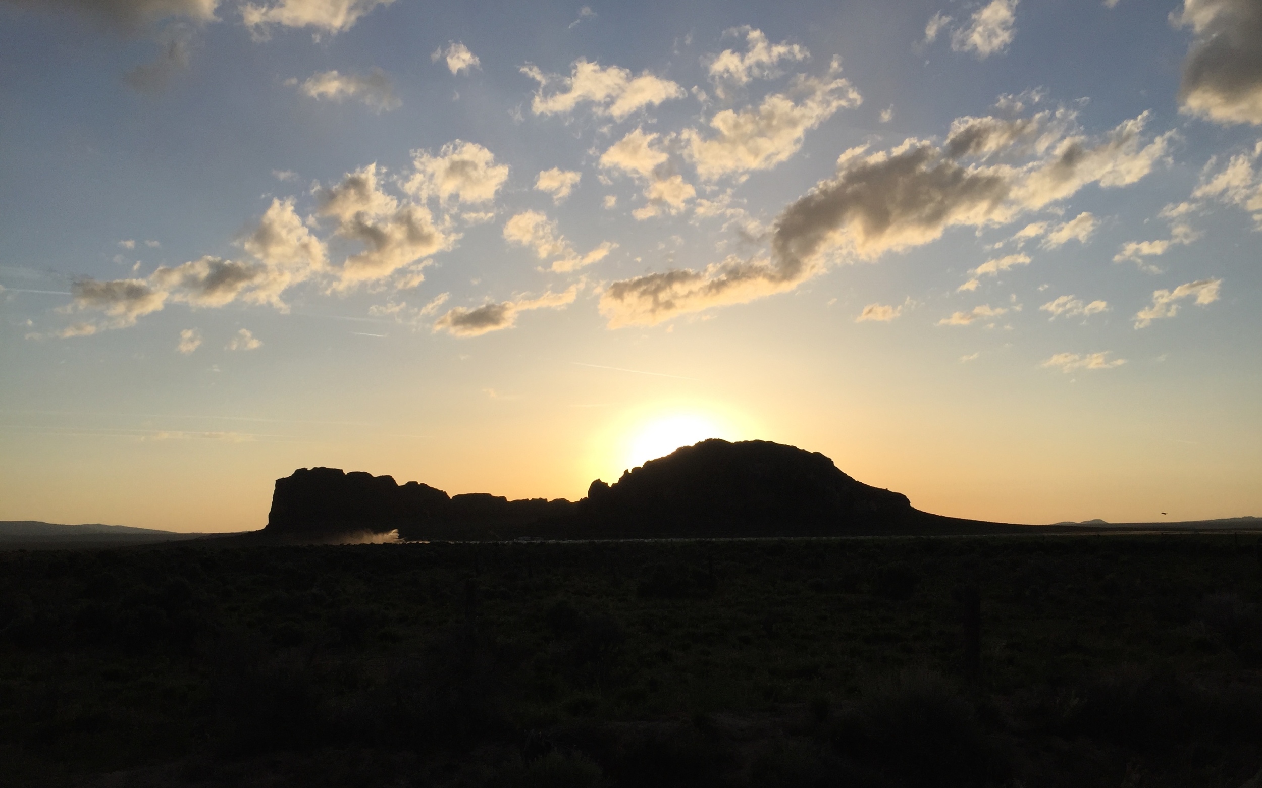
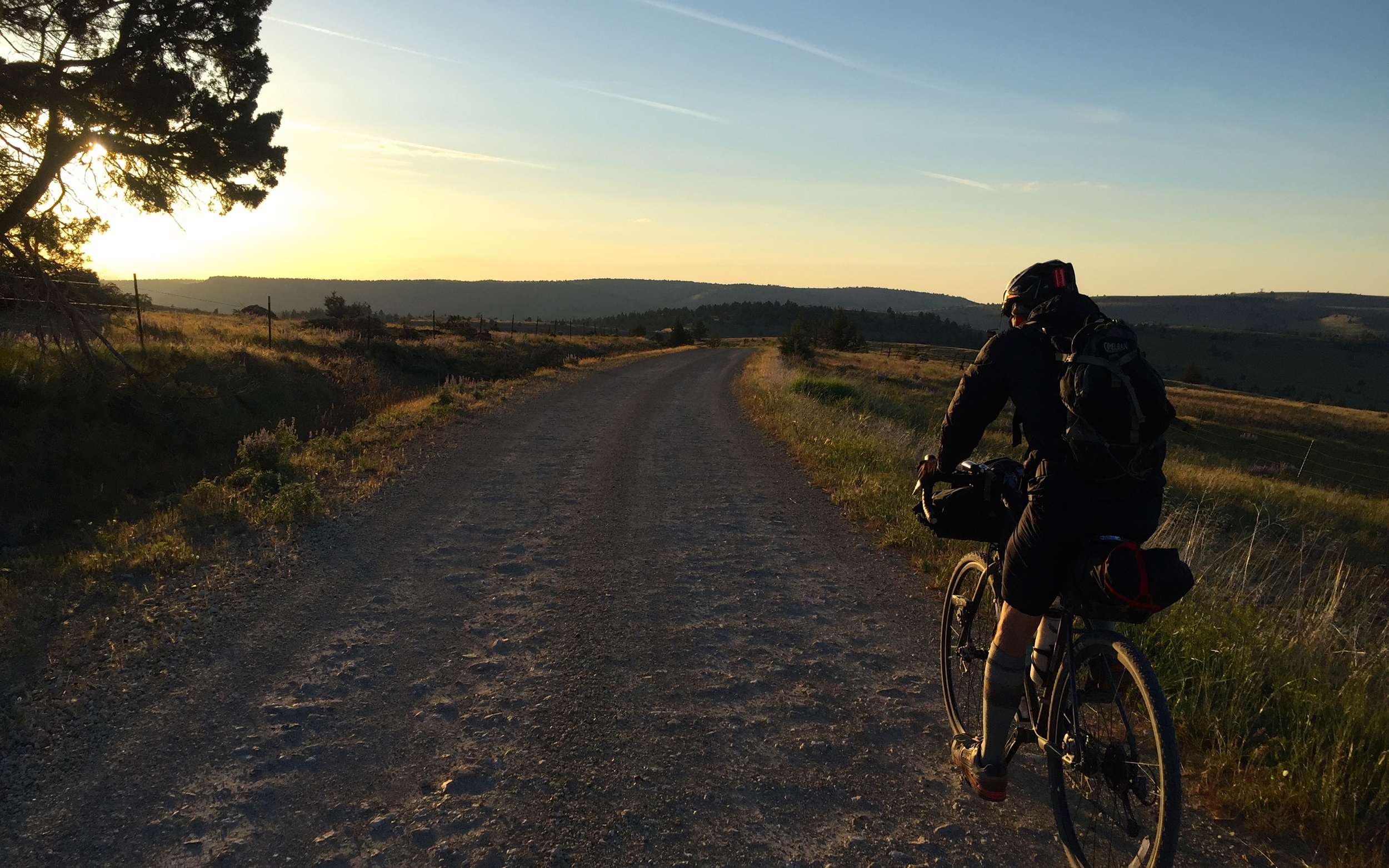
It must be the anticipation of seeing Fort Rock, but I seem to remember the road from Silver Lake to Fort Rock the most vividly of any stretch on the Oregon Outback. Or maybe just ‘cause it’s simple to remember: you go due north on a gravel road that false-flats uphill for a couple miles before climbing in earnest and swinging left. There’s one single house out there on the right, then you turn back north, climb, and summit the false summit, before the real summit, then BOOM!:
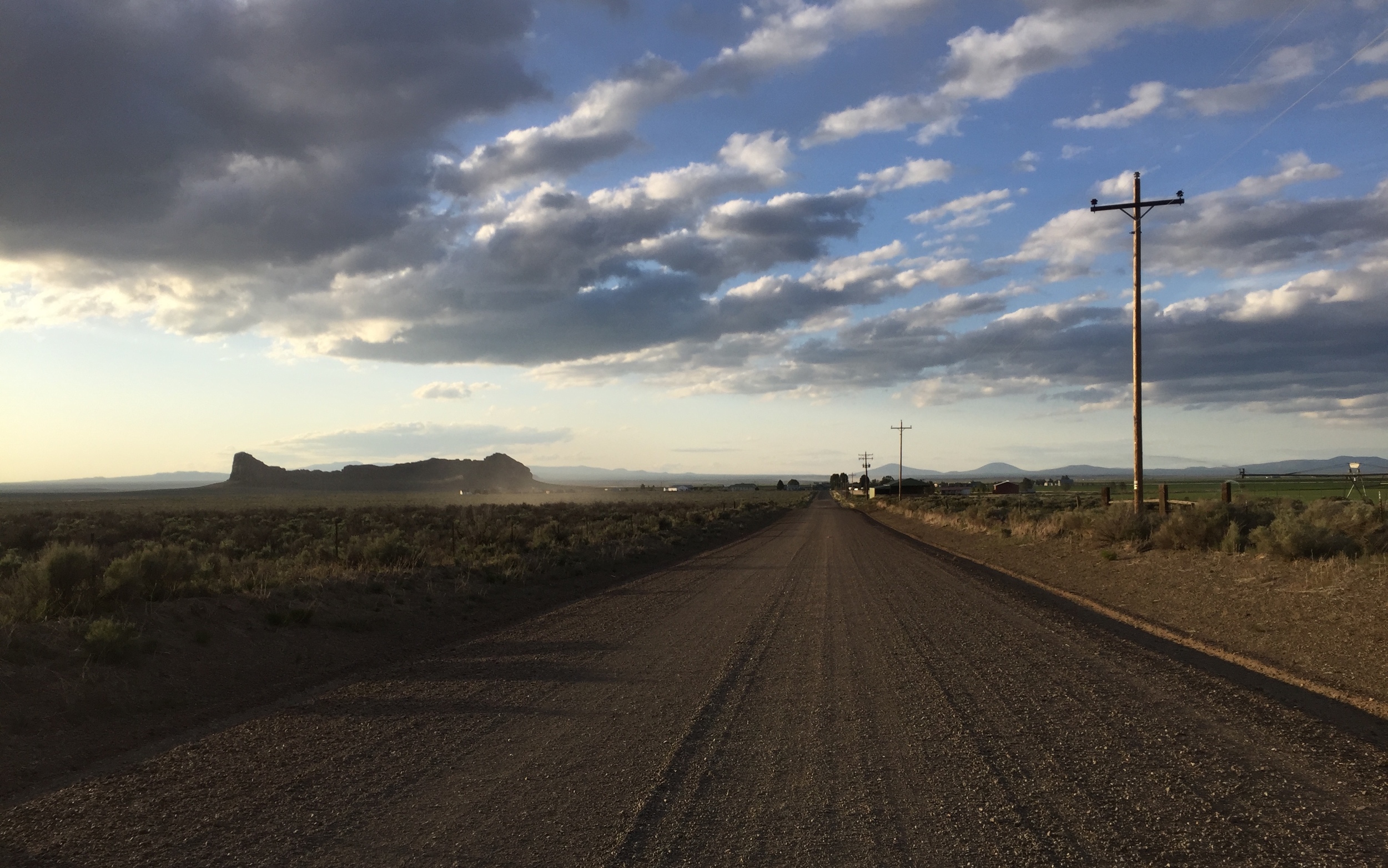
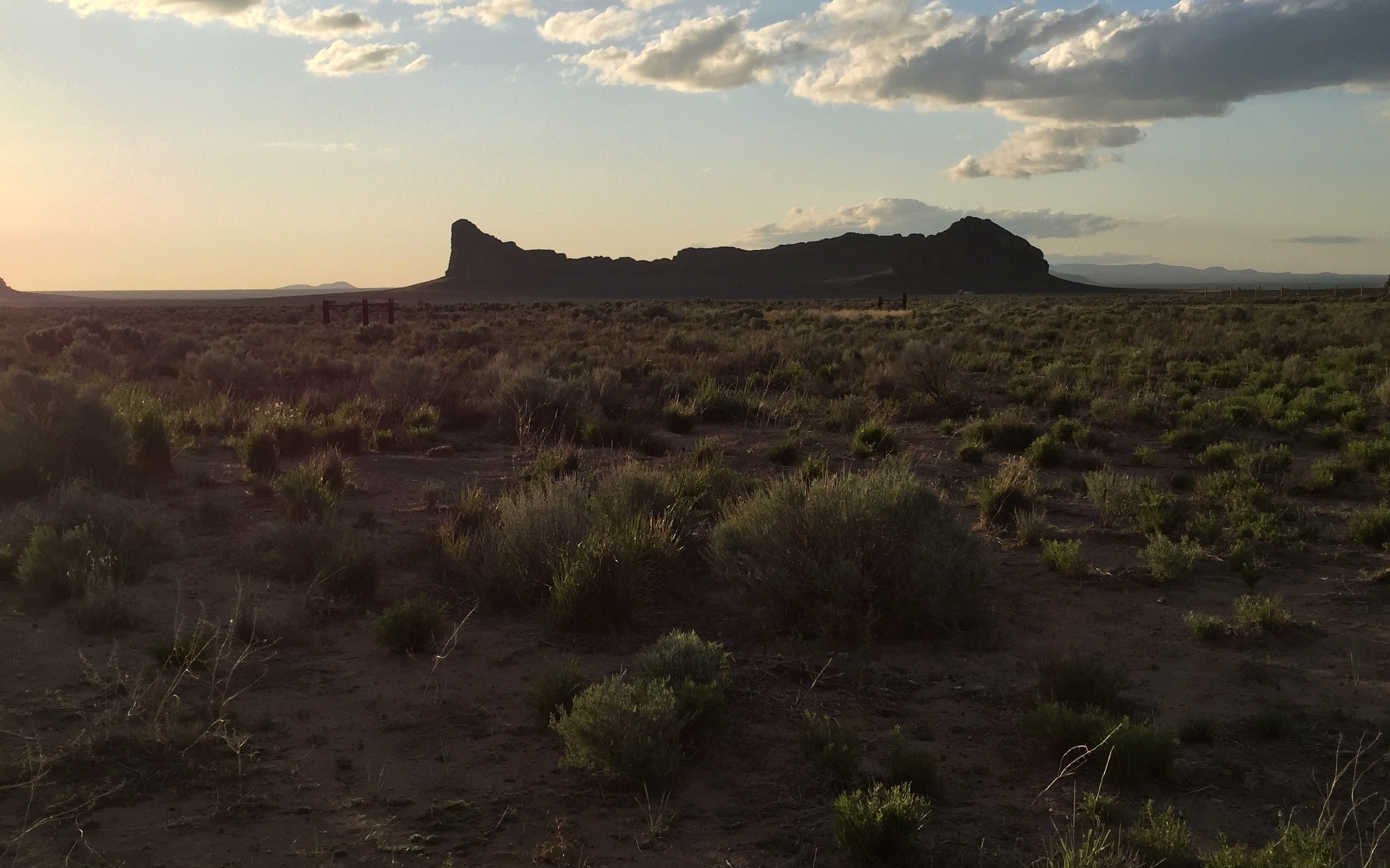
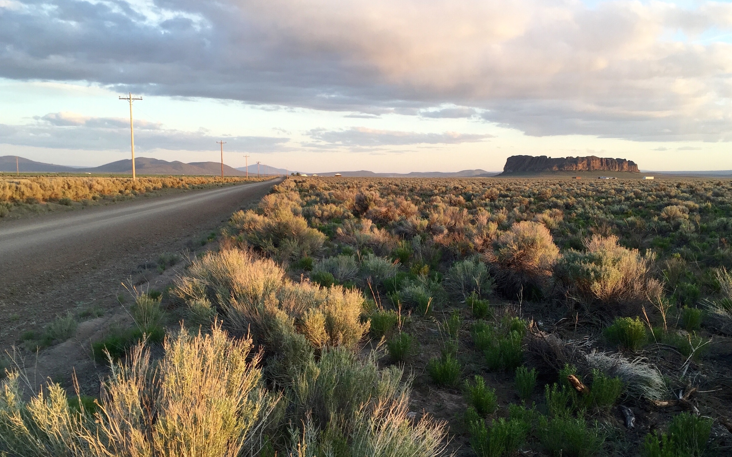
You summit the little crest and look at the next wide-open drainage and there it is: a goddamn stratovolcano spaceship parked in the middle of a vast sagebrush prairie.
Fort Rock is so cool: a semi-circle 4,000 feet across, 200 feet high, and bright, screaming red during Golden Hour.
Hitting Fort Rock during the evening has that heavy bikepacking-as-spirituality vibe, and Eric and I definitely had our third eyes opened by the time we hit the town of Fort Rock. We stopped to fill up water at the friendly-as-ever Waterin’ Hole Tavern. They filled up our bottles straight from icy water pitchers, and Eric slapped down a fiver as payment, walking away before they could refuse.
We rolled out of town, staring left at the ancient, fossilized spacecraft that, as far as I could tell, held the mysteries of the Fibonacci sequence, the Golden Ratio, agriculture, Norse sea travel, the Mayan pyramids, etc.
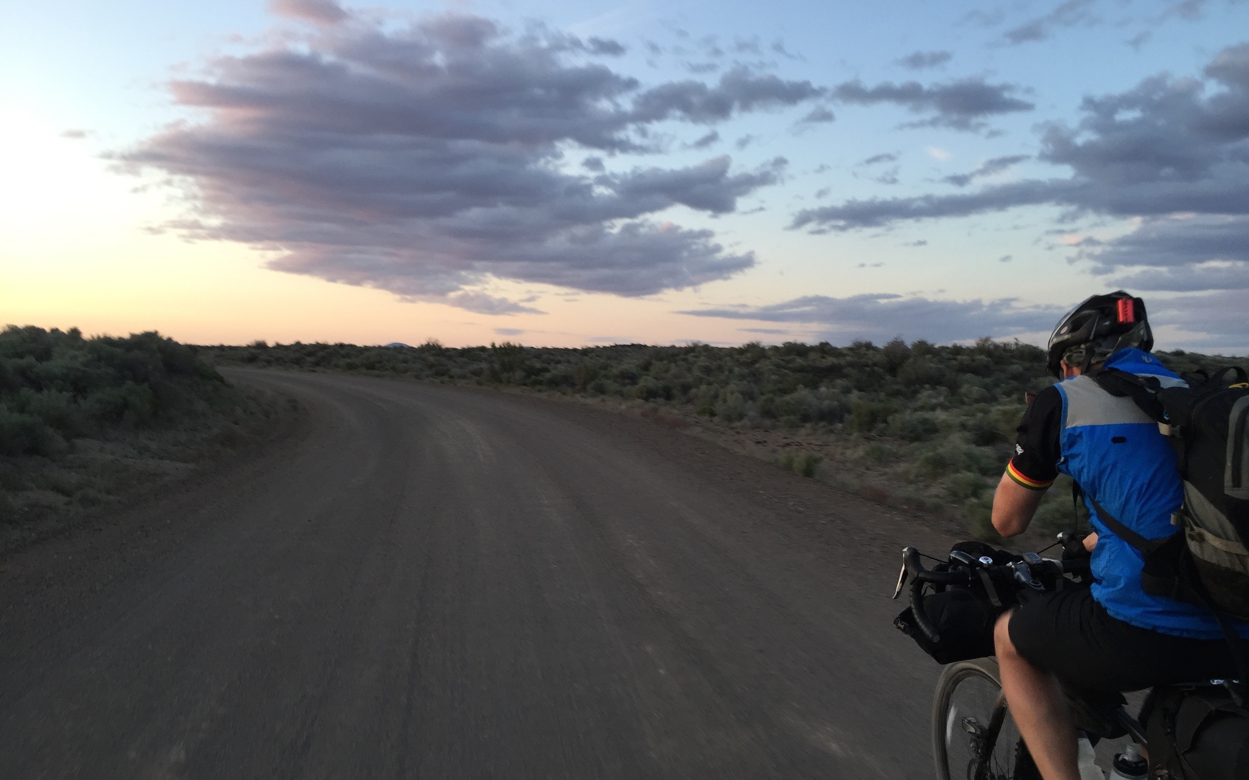
We’d forgotten all fear of the national forest after seeing Fort Rock at sunset, but we started remembering the shop keeper’s warning as we climbed into the woods, and the dark, with its forest fires and laughter flittering through the trees. Gunshot blasts started firing off, with increasing volume and frequency, and Eric’s climbing pace ground to a halt.
“I’m falling apart, man,” he admitted. “I’ve gotta find a spot.”
I assured him that we’d find better sites shortly, but as we kept riding, I started to second-guess my advice. He should have set up camp at the beginning of the forest.
“I’m just gonna stop. This is fine.”
We said our goodbyes, as I was set to push on 15 more miles that night, and on to Shaniko the next day.
A few minutes further up the road, I heard what sounded like an actual cannon in the woods. Were these rednecks shooting off a fucking bazooka? Blowing up dynamite?
I quickened my pace, hoping the best for Eric alone in his bivy with minimal tree cover. This was my second year pushing on alone through Deschutes National Forest at night. I knew that there was only one turn that mattered, and then the rest of the course was just not turning, so I didn’t have to waste any time double-checking my location like the year before. I knew that the drunken “rednecks” shooting guns in the woods were actually nice people, and that any menace I felt was just the amplification of my imagination in the night.
The calculations and bargaining began at 10 p.m.
If I maintain 10mph, I can get to mile 170 by 11:15, and be asleep by midnight so I can wake up by 7 and be riding by 8 and be in Prineville by 1, so I can make it to Shaniko by 10 tomorrow. But if I stop at mile 165, maybe I can wake up at 6:30 and be on the road by 7:30 to be back on track by 1, end...
I settled on just riding until 11, and stopping wherever the hell I ended up.
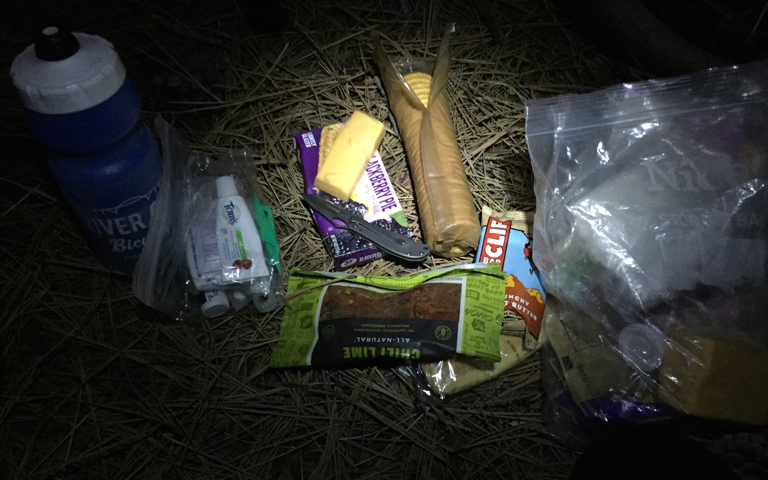
I couldn’t find a real campsite, but at least there was no way that anyone could drive their car over me in the middle of the night, I though. I walked 100 feet off the road, to a nondescript needle bed in-between some trees, blew up my air pad and set my bag out to loft up. I ate my dinner of cheese, crackers, summer sausage and an apple.
I hit the sack at midnight, right on schedule, and scrolled through the day’s photos on my phone, fully cinched inside my sleeping bag for another cold night.
DAY 2 / Mi. 165-305: REDEMPTION ON DIVIDE ROAD
The goals of Day two were to succeed where I’d failed last year: to get to Divide Road and its incredible views of the Cascade volcanoes before the sun went down, and to get past Antelope with its awful, illegal campsite to Shaniko with its wonderful, fully-legal campsite in the center of town.
It was cold in the morning, so I did my now-familiar changing ritual of pulling my chamois and jersey out of the sleeping bag’s silnylon stuff sack (also my pillow) without getting out of my sleeping bag, then shimmying into my cycling kit, then my leg warmers, then my long-sleeve shirt and my puffy coat before getting out of bed. I’ve found that even though the kit is still wet with sweat from the day before, it’s way warmer to keep it all in the sleeping bag with you and put it all back on under your warm clothes than to try to dry it out overnight—unless it’s a really mild night.
My sleeping bag was soaked with condensation, so I hung it on a branch facing the sun as I ate breakfast and packed everything else. Just like Jonathan Maus the year before, Eric rode up as I was packing up.
“Yo!”
He stopped and relayed the tale of the mortar shelling he “slept” through the night before.
“Well, I’ll try to catch up to you on the road.”
The sleeping bag took awhile to dry, but I got on the road not long after 8.
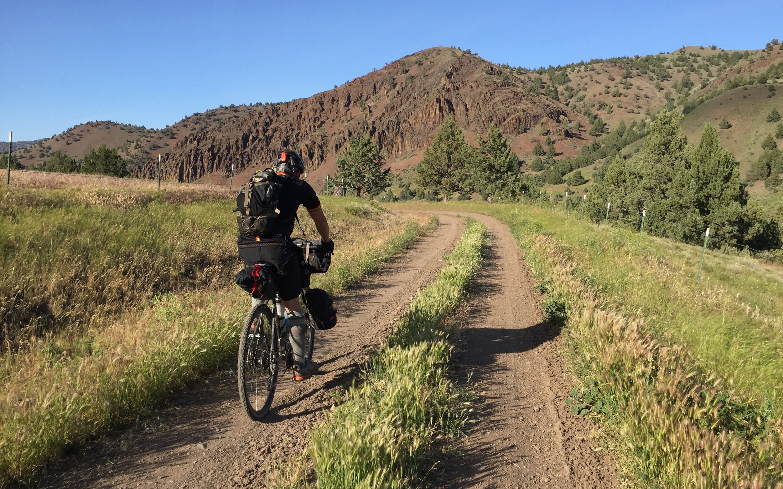
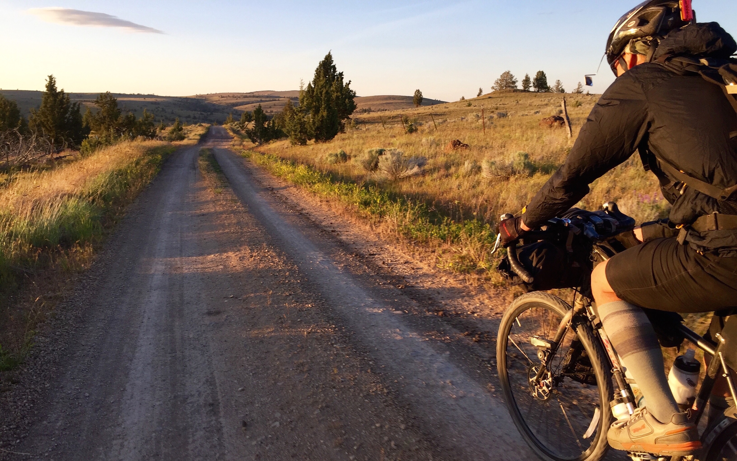
The “red sauce” of the Deschutes National Forest was basically a non-issue this year, but the roads on the way out of the forest were carved into some of the most extreme washboard I’ve ever seen in Oregon—rattling your glasses off your helmet on the downhills with no good line to choose. I rode the deep sand of the quad track next to the road a few times, just as a respite.
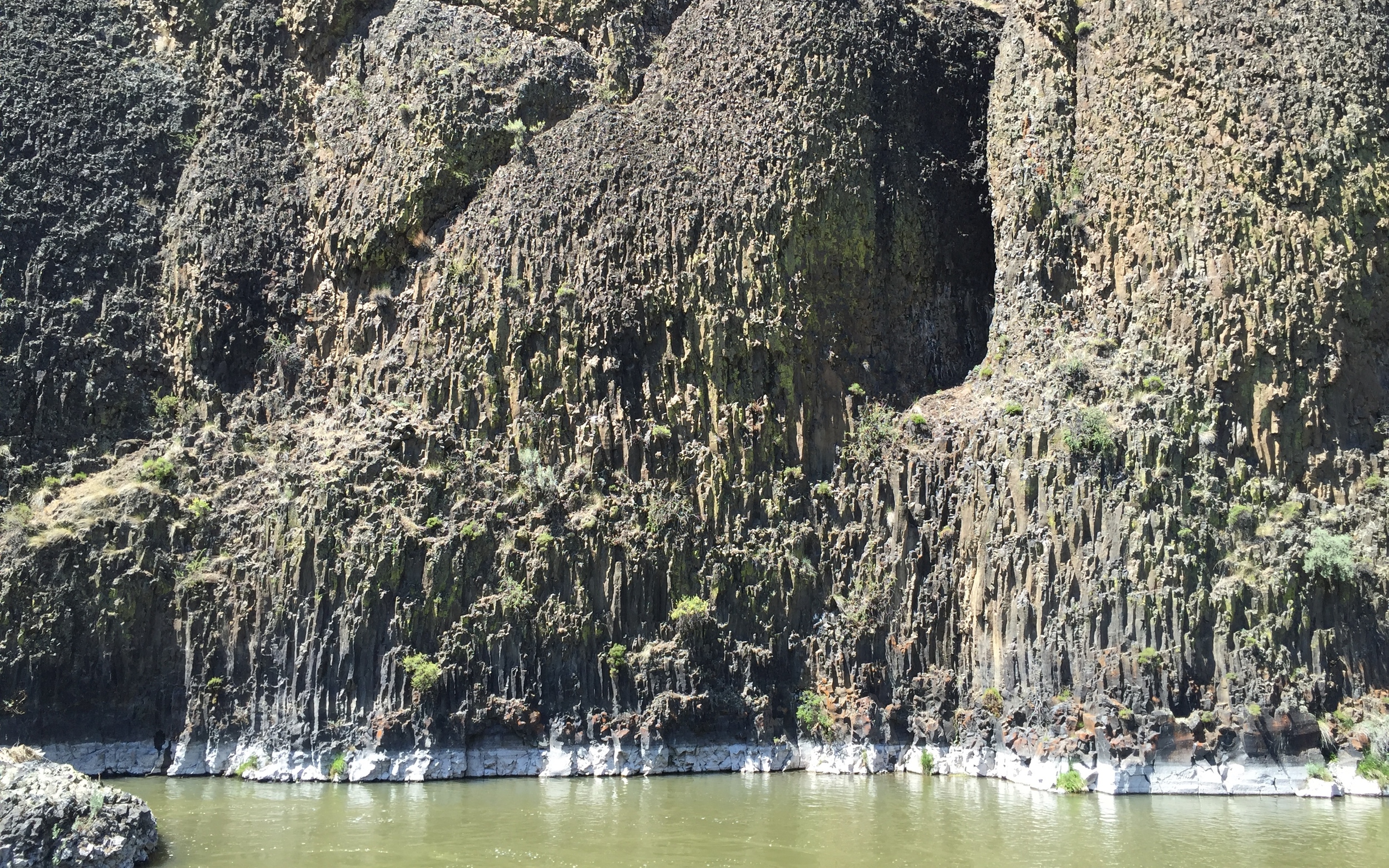
Ultimately, though, nothing was holding me up, and I made it down across the boring stretch by Highway 20 to the awesome, red clay road descent to start the Crooked River Highway. The miles into Prineville are some of the fastest on the entire route, and I imagined myself closing in on Eric as I hammered over the climb to Prineville Reservoir, then down the Crooked River Canyon with its paved road and its spectacular views.
I saw Eric just as we hit Prineville, mile 65, and accelerated to catch him at the main intersection. We decided to set up camp at the town’s bike shop, which was committed to staying open and supporting the Oregon Outback riders, even though the event was officially cancelled.
We bought sandwiches from the Subway around the corner, and ate, resupplied, packed, drank coffee and talked plans at the shop’s shaded, outdoor table.
Eric had originally planned to camp in the Ochoco Mountains, 25 miles up the road and 2000 feet above Prineville—but he was way ahead of schedule after riding with me the night before, and figured he might as well press on again. I told him that there’s basically nowhere to camp between the Ochocos at mile 250 and Shaniko at mile 300—it’s ranches with barbed-wire fences along the road. He’d be committing to riding into the night with me again, but we’d get a great view of the Cascades at sunset and a nice campsite with running water and a bathroom in Shaniko.
Eric decided to go for it, and we rolled out of Prineville about 3 p.m. toward the long, easy climb into the Ochocos.
One day I’ll drive a car to the Ochocos with a road bike and do the climb up Road 27 without a bunch of bikepacking bags. It’s a beautiful climb, and it felt easier this year than ever before. I showed Eric the intersection where I made my wrong turn last year and lost over an hour descending, then climbing back up to the top.
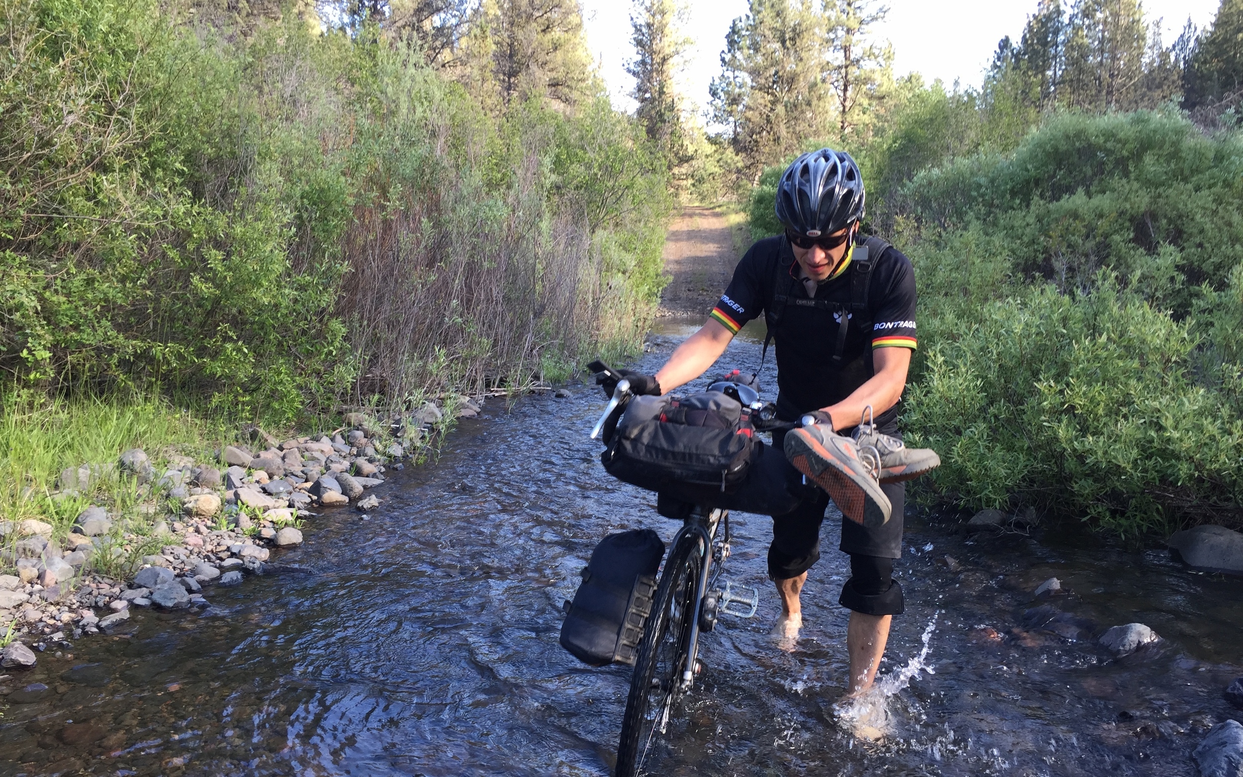
The actual descent is an absolute ripper—2,000 feet down a gravel road that turns into a rocky 4-wheeler road with multiple creek crossings. I’d learned a technique the year before where I took off my socks and rode loosely in my unstrapped shoes in-between river crossings, then walked through the creek barefoot. The water was too high to ride through most of the crossings this year.
I probably annoyed the hell out of Eric telling him about what time it was last year and when i got a flat two years ago and how muddy it was last time, but the trail kept bringing back memories.
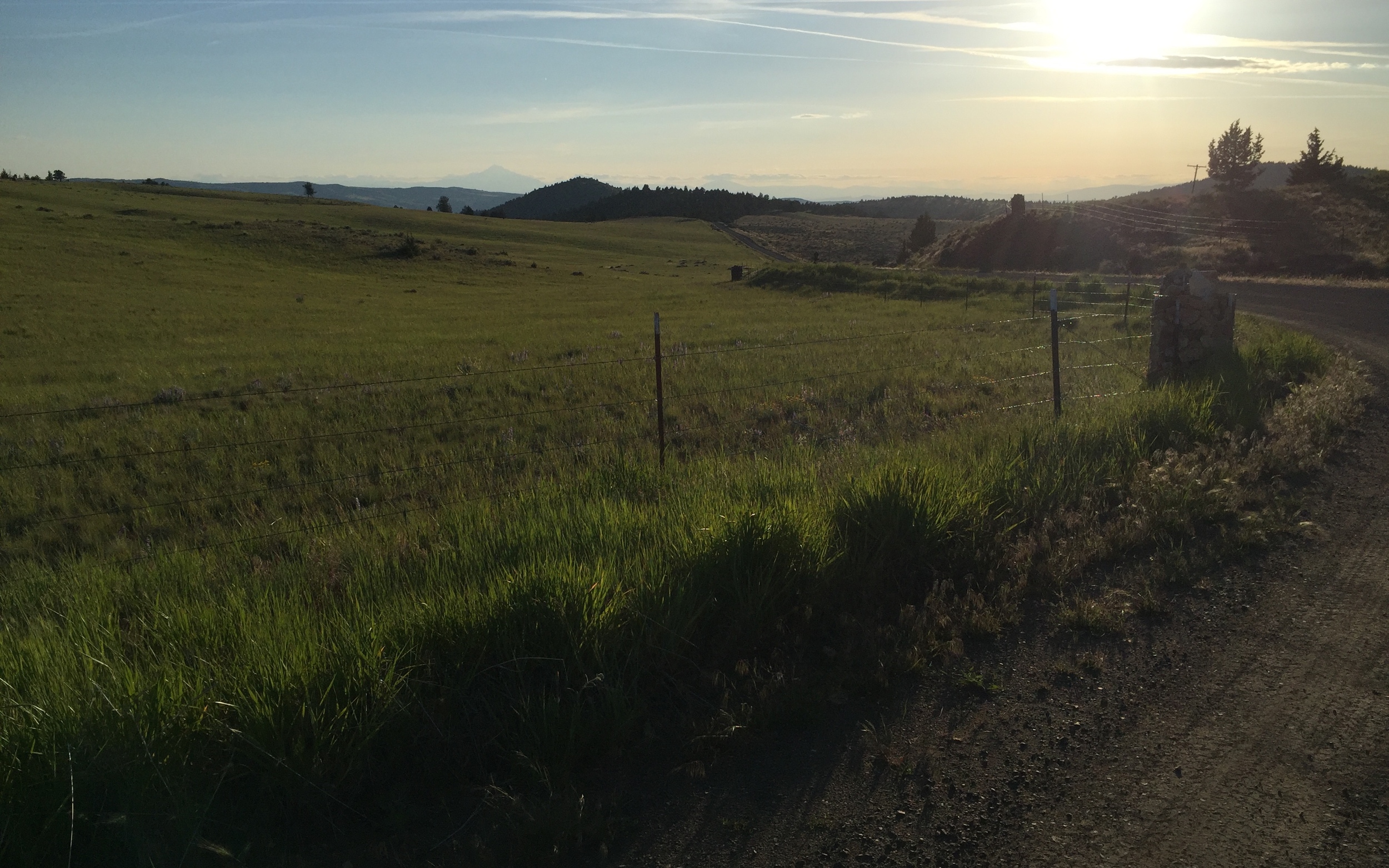
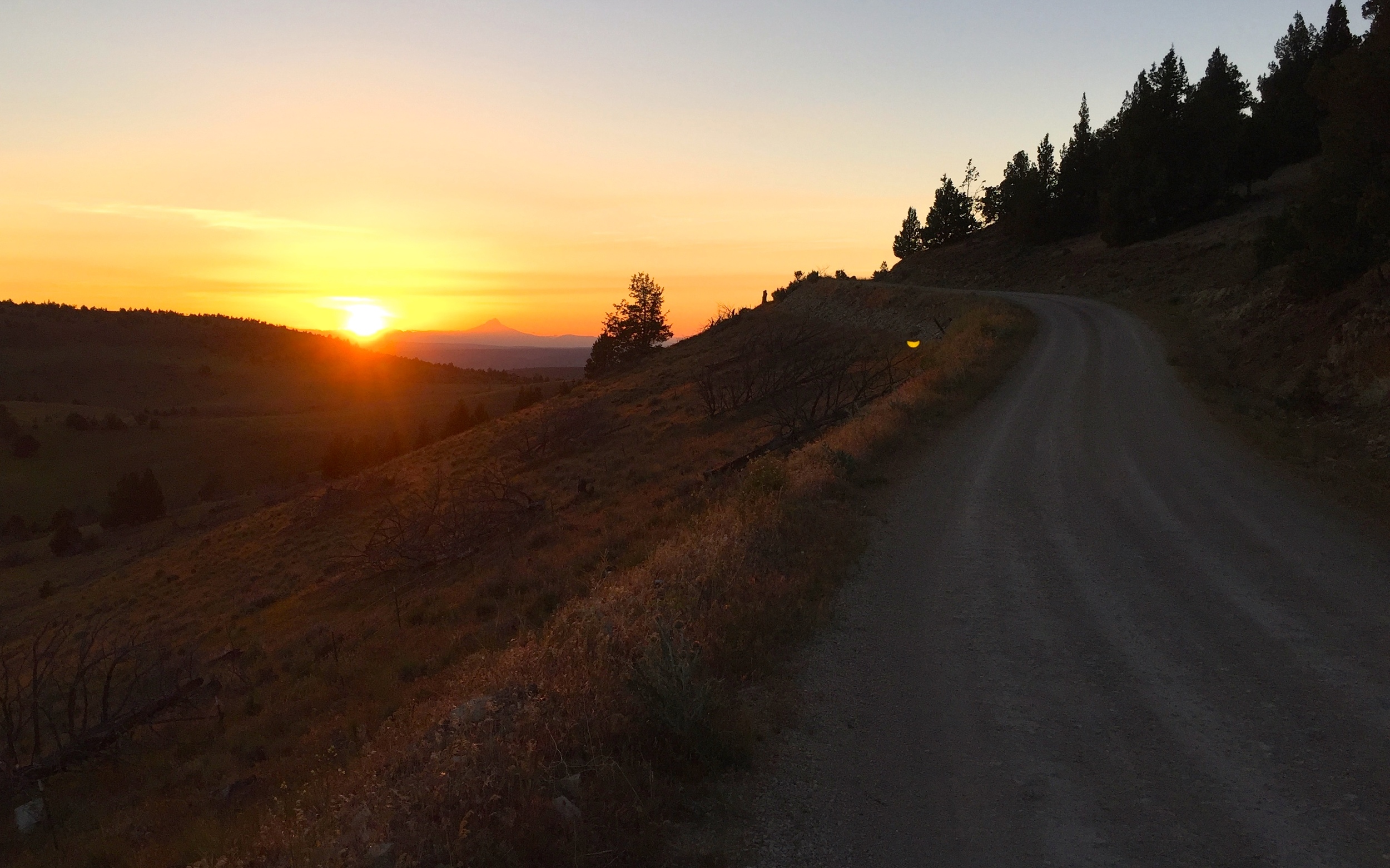
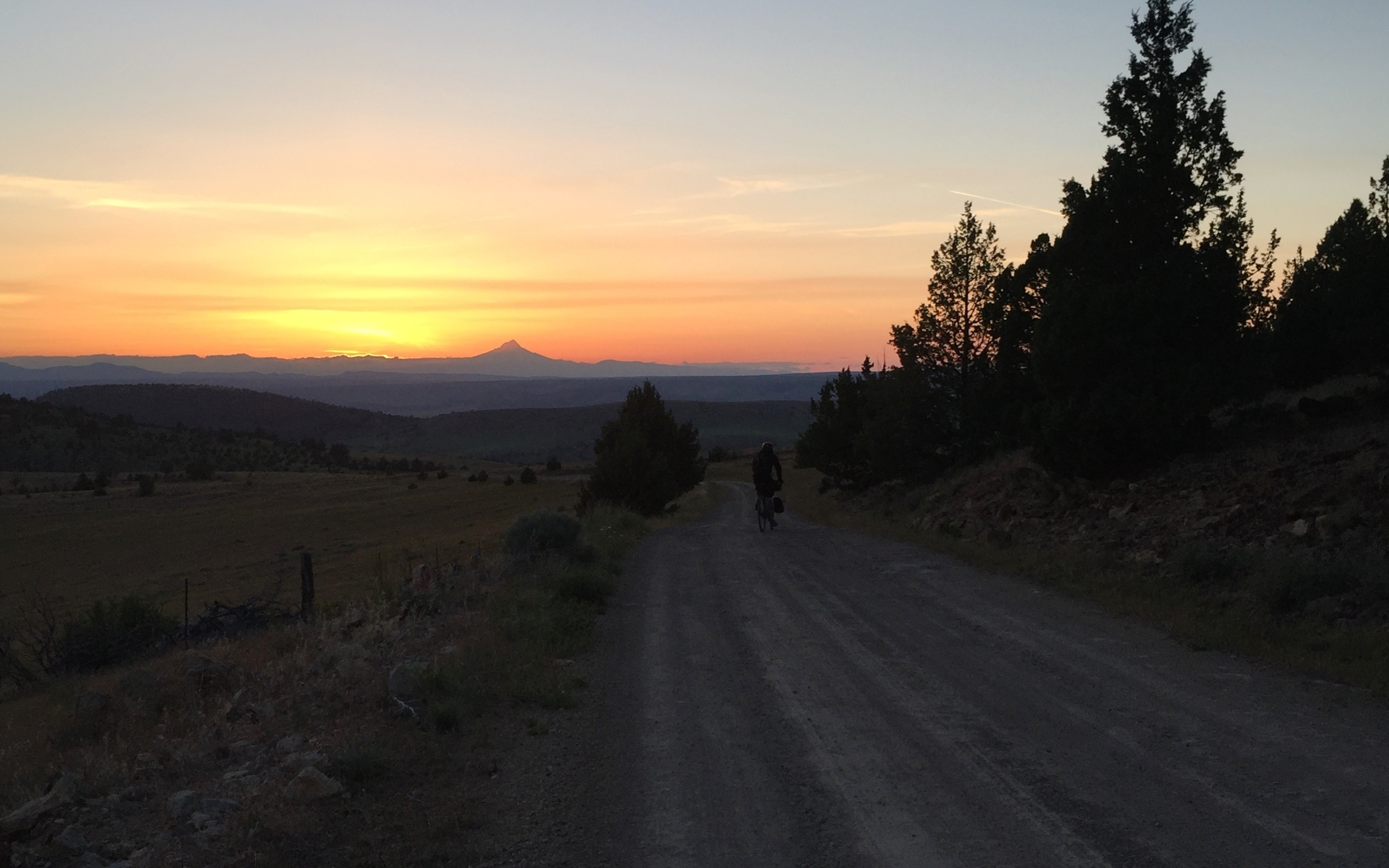
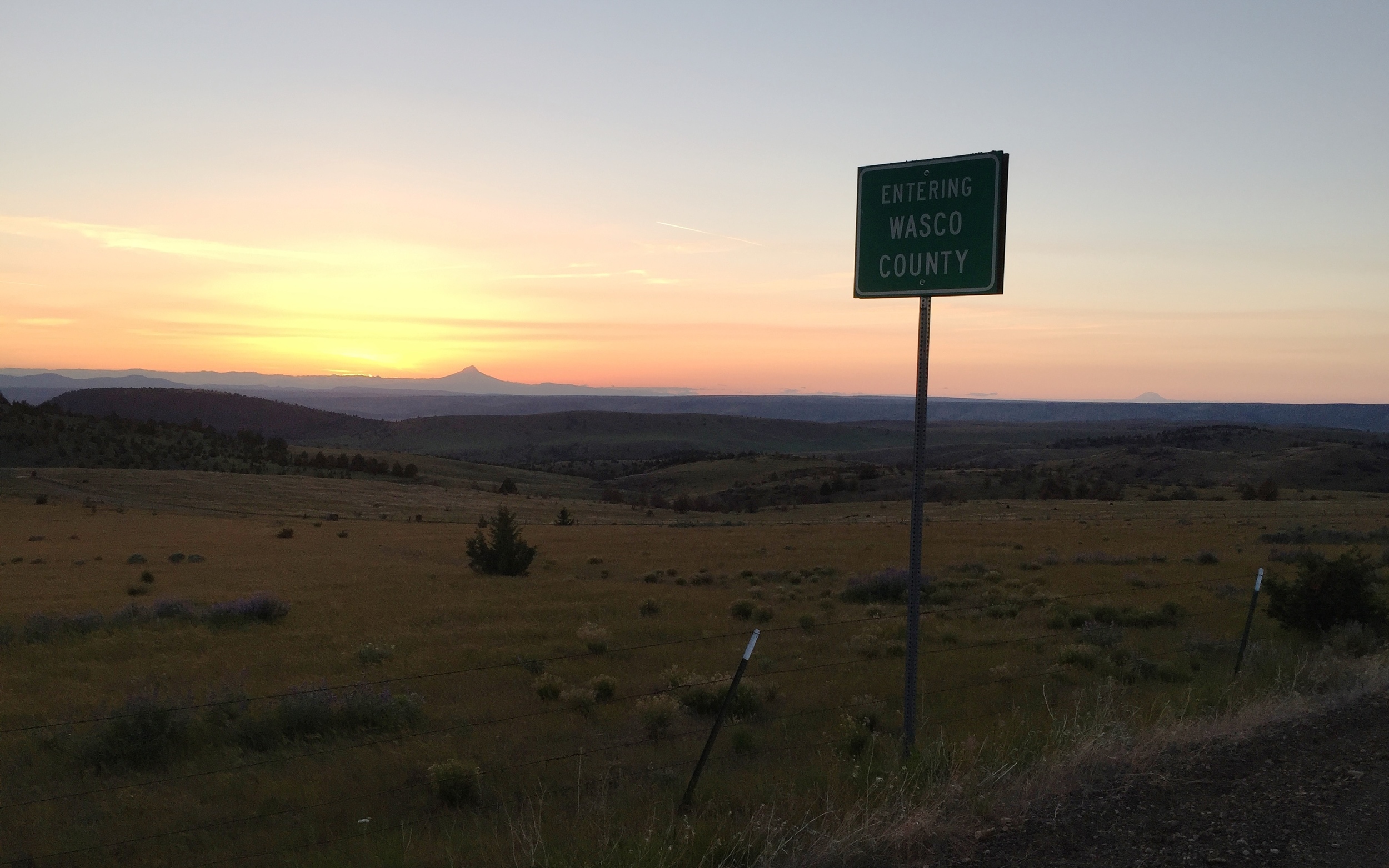
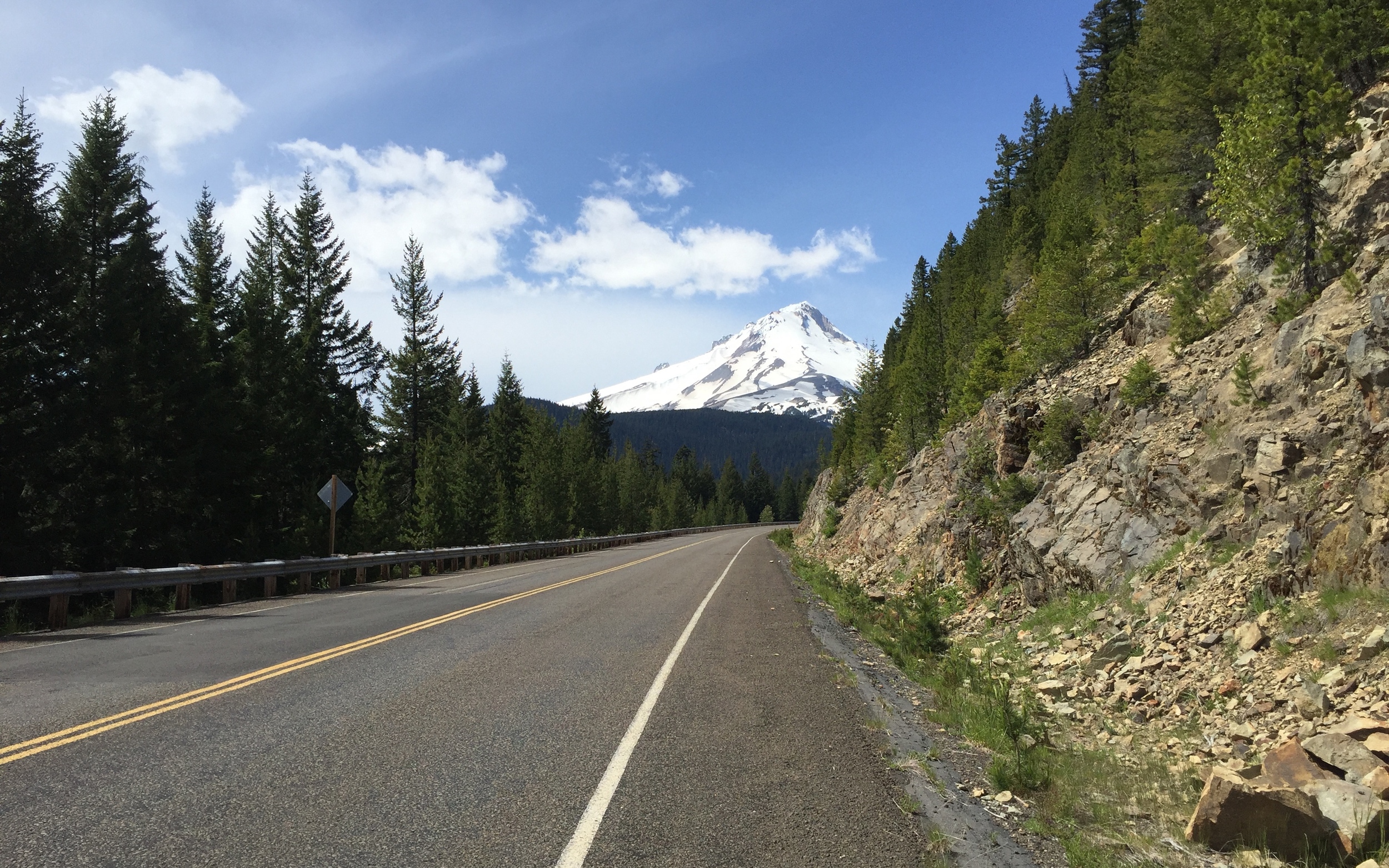
We finally hit Ashwood and the bottom of the climb to Divide Road at about 7 p.m.—way ahead of my pace the year before. Eric had a lot more weight on his bike than me, and I started dropping him halfway up the climb. I decided to cut the elastic and get up the road a ways to frame the epic view of Mount Jefferson I knew we’d get from the top.
We arrived at the top and Divide Road at the absolutely perfect time—getting the kind of views that will be seared into my head forever. The sunset seemed to last forever as we stopped to shoot photos, rode on a bit, then beheld an even more spectacular view and stopped again.
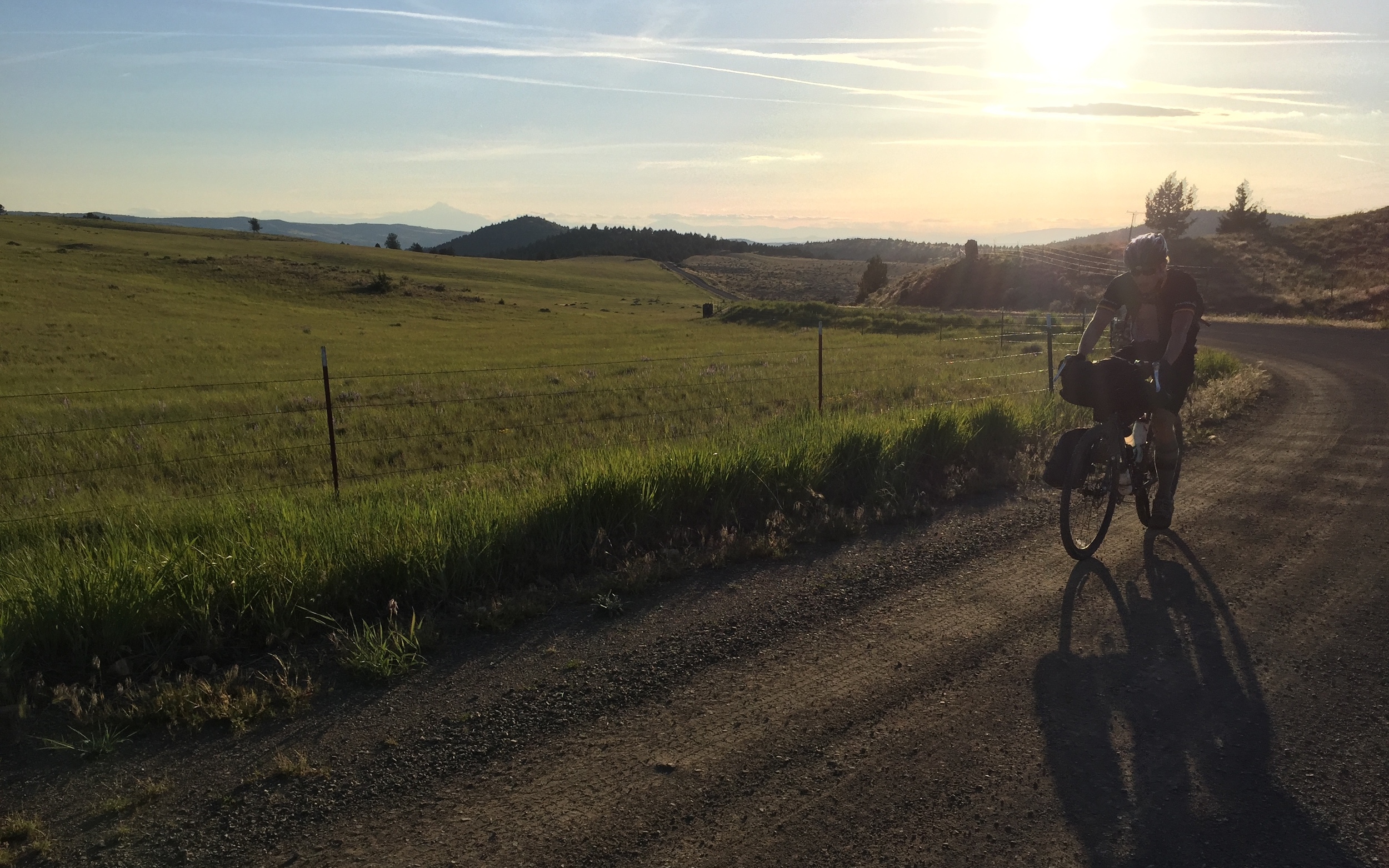
The road wound to the right of the divide and finally out of the sun’s light, and we figured that was it, until a slight downhill slid us back around to the left of the ridge and we saw some grass lit up on the side of the road ahead. Could there possibly be one more sliver of light left in the day?
We came around a corner and caught our first view of Mount Hood just as the sun set over the horizon.
Seeing Mount Hood for the first time on the Oregon Outback is a powerfully symbolic experience: you’ve made it most of the way across the state. You went all the way from practically California, and now you can see the mountain that overlooks Washington. You’re practically there!
We still had 20 not-exactly-easy miles to go before Shaniko, though.
We blazed down the big descent off Divide Road to Cold Camp Road, skirting the site of the famous 1980s intentional community/cult of Rajneeshpuram (look it up if you haven’t). We made it through the ranch where I’d unintentionally chased a team of horses down the middle of the road the year before. Finally we saw the headlights of a car in the distance on Highway 218. We stopped at the highway and turned on our blinky lights for the next 13 miles of nighttime riding on the rural highway.
It was a shame to ride through rustic Antelope and the beautiful, snaking climb up to Shaniko at night, but I knew from experience that camping in Antelope was not worth it (especially since the park has a sign that says “no overnight camping”). I felt the need to keep explaining to Eric that this climb was really cool looking and that he had to come back and check it out during the day. He dropped back, loaded with extra weight (and maybe sick of hearing about the views he was missing). No KOMs for either of us this time—loaded down and riding the climb after 132 hard miles on the day—but we made it up efficiently, and rolled over the top toward the lights of Shaniko five miles in the distance. Even though it was 10 p.m, the outline of Mount Hood was etched clearly into the sky ahead of us.
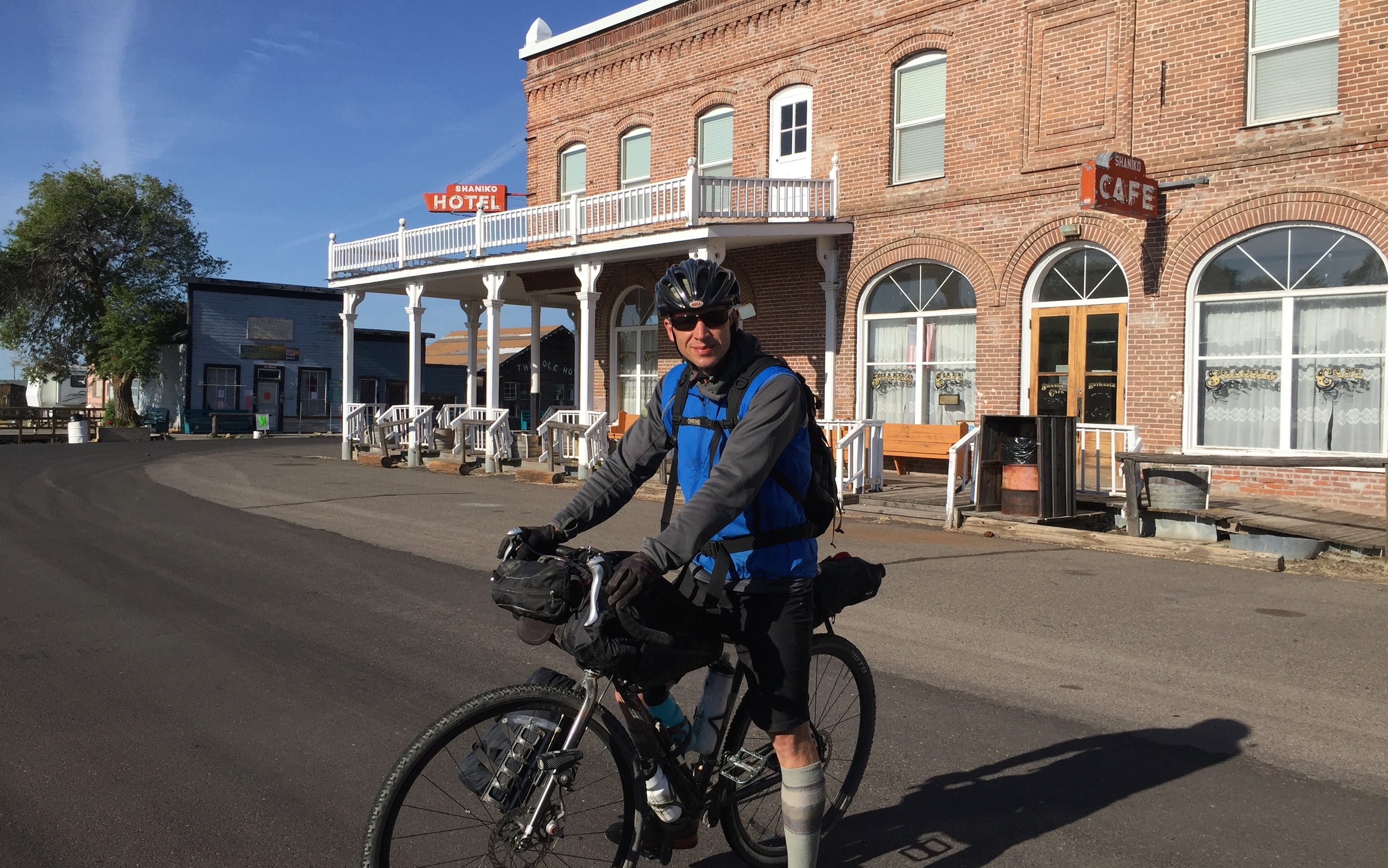
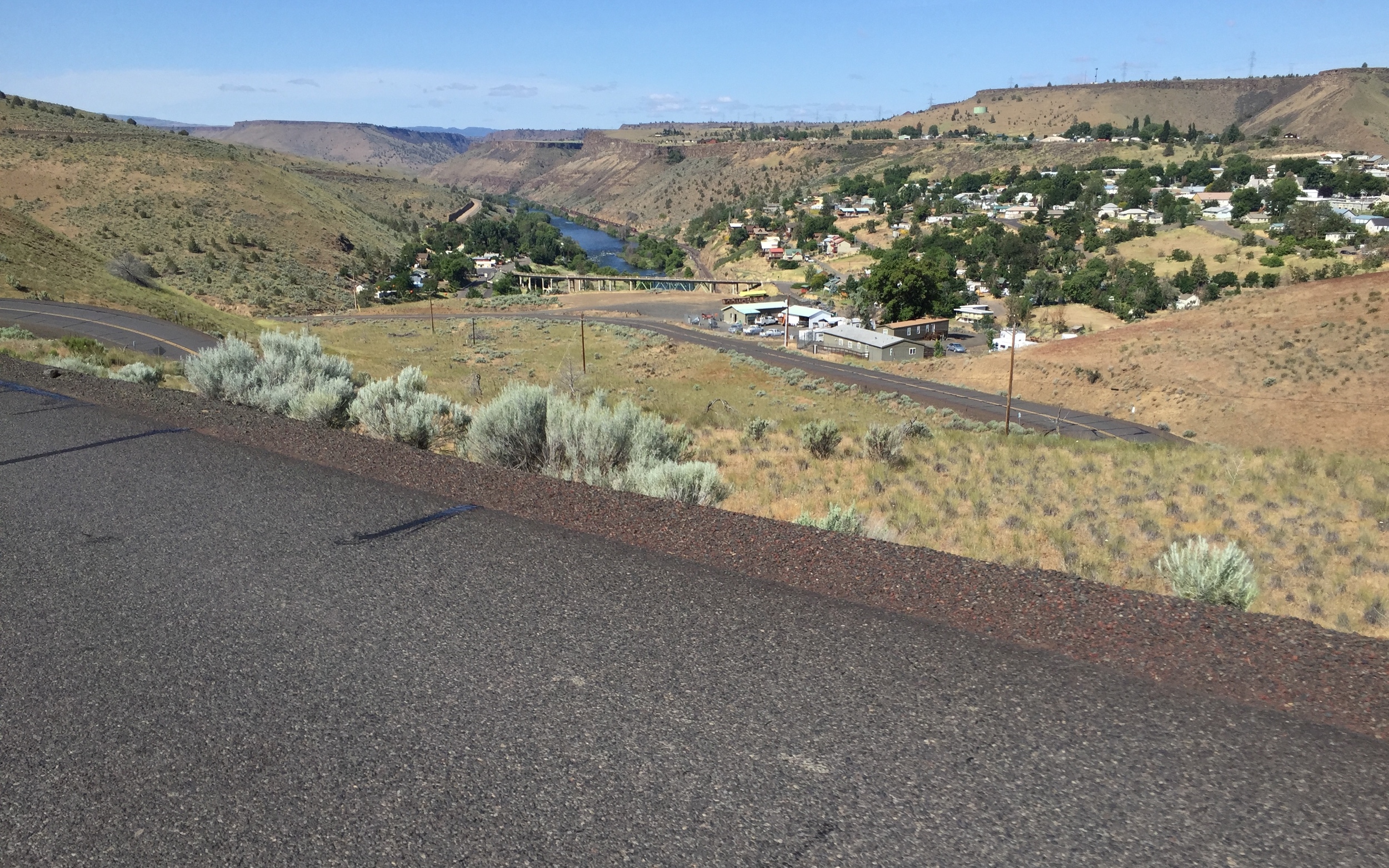
We arrived in Shaniko well before my 11 p.m. estimate, and set up in the little park between the ice cream shop and the historic (closed?) Shaniko Hotel. The park has a picnic table, a hose with all the running water you can drink, an unlocked public bathroom down the street, and soft grass to sleep on. But the coolest part is its location dead-center in the middle of the perfectly-preserved, old-West buildings of Shaniko. The town resembles the set of a spaghetti western film. You can easily imagine two gunslingers lined up at either ends of the block, prepared to draw.
Eric had a stove and an extra boil-in-bag meal that he never used the night before, passing out in the Deschutes forest. He offered it up to me, and we feasted on everything we had, knowing that the Shaniko General Store down the street would be open the next morning.
DAY 3 / Mi. 305-400: BACK FROM THE OUTBACK
The original goal was to ride the Outback to Shaniko in two days, then b-line it to Portland on day. I wanted to add another layer of challenge to the route and I wanted to avoid finishing at the Deschutes River with no ride back to Portland. But the idea of riding until 11 at night again, before going into work the next day at 9 a.m. was too ludicrous. I’d be a disaster the next day. My friend Andrew had offered to bail me out if things got crazy, so I took him up on his offer and coordinated for a pickup at Zigzag in the evening, skipping the last 50 road miles into Portland.
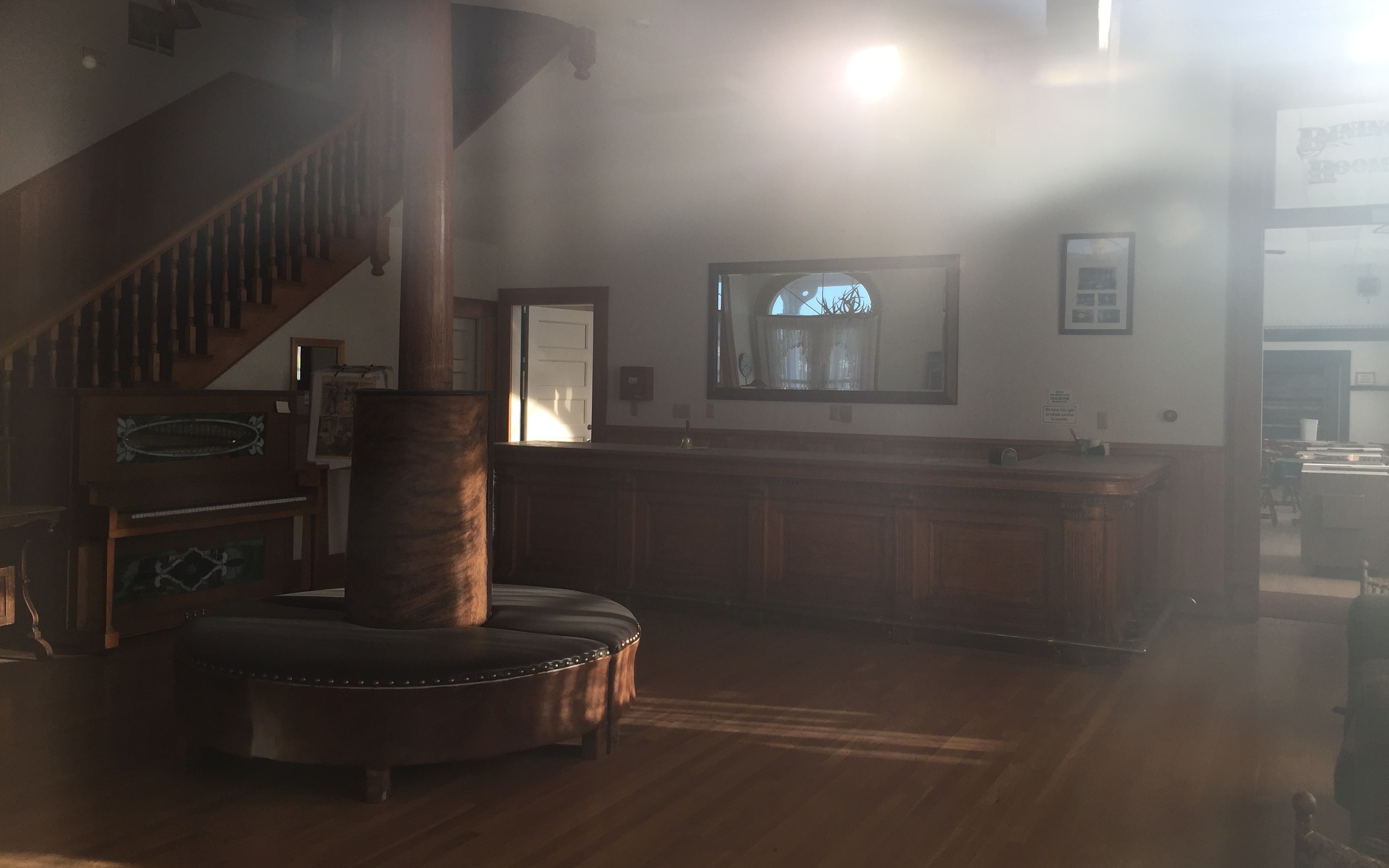
Eric and I checked out the vacant ghost town in the morning, grabbed coffee and food from the general store with its perennially-stonefaced owner, and said our goodbyes. It had been a brilliant stroke of luck to run into another dude who was riding the route on the same day, at the same pace. We wished each other well and promised to send each other our photos.

I rolled out at 8 a.m. down Bakeoven Road toward Maupin. Apparently my great grandmother on my dad’s mom’s side is fro Bakeoven, and I imagined reconnecting with long-lost relatives and staying on their ranch one day as I blasted through the remains of the town.
The descent into Maupin is another road that deserves a proper road ride one day, and I blasted down the snaking corners with my phone out, trying to get photos of the idyllic fly fishing mecca below. I hit the rafter bro-centered store next to the Deschutes, got some coffee, beef jerkey, bearclaws and Doritos for my second breakfast. The town of Maupin is uphill from the river on a semi-major highway, but the traffic that Memorial Day morning was all pleasant and courteous as I crawled along the narrow shoulder.
I made it to the high shelf above the river, then descended back down to Tygh Valley—familiar from the Oregon Stampede route. From Tygh, I departed on the new-to-me Barlow Road route, beginning my 40-mile climb to the side of Mount Hood.
After the quiet, forgotten towns of Eastern Oregon, I was surprised to find that Wamic is a bustling tourist town with abundant food options. I ordered a hot dog from the food cart, filled up my bottles, and put in my last Nuun tablets, hoping it would be enough to get me to Still Creek.
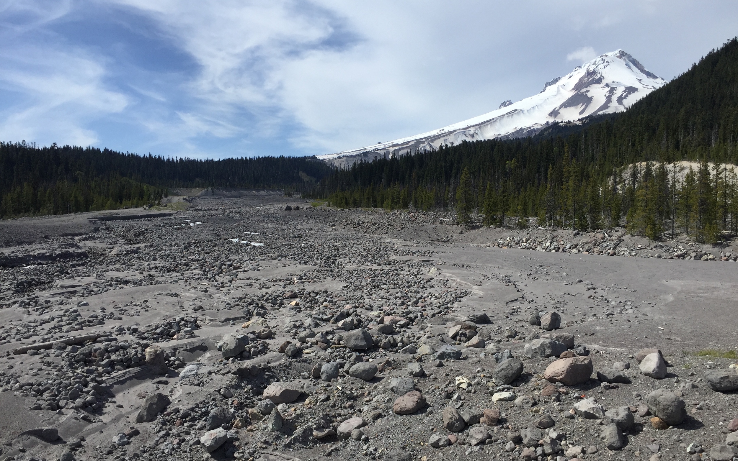
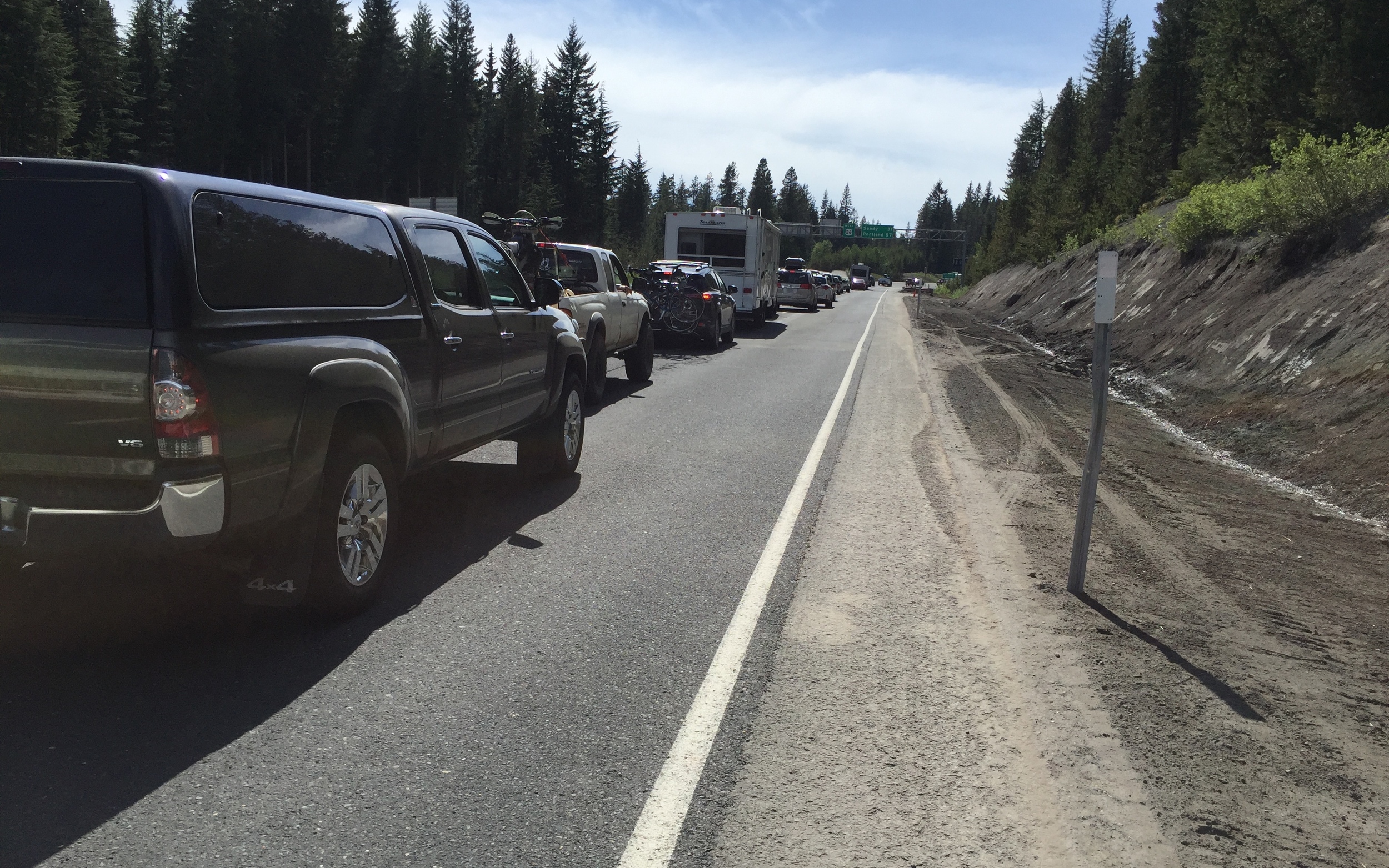
The traffic got awful after Wamic, and some of the campgrounds along Barlow Road looked similar to the mayhem of the Deschutes National Forest—completely jam packed with weekend warriors in RVs and those huge tents with like three rooms. I shuddered to think about how many Budweisers the sunburned dads driving by me had drank before leaving camp as I heard the sound of their strained F350s pushing 60 mph uphill with a 30-foot trailer in tow. And with the congestion came the heat. As I crested the false summit, then descended back down 800 feet, I calculated that I’d run out of water well before I hit Highway 35 at Barlow Pass and could filter from the glacial runoff in the White River.
I began to hate every family that blasted by me—I imagined the coolers of water that they carried, the 2-liters of Mountain Dew, the bags of uneaten Doritos.
I ran out of water several miles before the top, but when I hit Highway 35, I decided not to stop for water anyway. I felt too embarrassed to filter water in front of a crowd of gawking idiots while they walked 100 feet from their RVs to check out some nature, so I continued on, dry-mouthed, around the side of Mount Hood, hitting a traffic Jam as Highway 26 met 35. I took out my revenge on the trailer drivers by attacking full-blast up the final climb to Still Creek Road, riding by an endless parking lot of trucks and RVs, overheating in the sun with their air conditioning cranked to full-blast.
Getting off that highway to hell and into Still Creek campground was by far the most relieving moment of the day. The campground was already empty, and I rode straight up to the faucet and drank two full bottles of water before filling them again for the cruise down to Zig Zag. One last piss in the woods and I was off.
I should have anticipated that Still Creek would also have traffic. No sooner did I begin the idyllic descent before I caught up with a cloud of dust and a convoy of campers getting around the traffic jam on Highway 26. I rode up close on the driver’s side, hoping they’d get the message that they were in my way and miraculously they did! All three cars pulled over in rapid succession and let me by! I blazed the rest of the way down Still Creek at 30 mph, wishing I could take a picture, but not wanting to risk getting caught by the convoy.
And suddenly I was done—sitting in the ranger station parking lot, waiting for a ride.
LESSONS LEARNED
Riding the Oregon Outback by yourself is certainly different from riding with 100 people. It’s not bad, not necessarily “worse,” but not the same. I missed catching up to other riders on the trail, and knowing that someone would be coming by if I waited a little while. And I feel extremely fortunate to have ridden half the Outback with Eric (what are the odds?).
The Oregon Outback remains an excellent route. There’s a train that goes to the start, a freeway at the end, and a whole lot of beautiful, remote country in-between. I’ve ridden it three times already, and I’d do it again—whether it becomes a “thing” again or not.
As for my “back to Portland” version: I’d probably figure out a different route next time to avoid Barlow Road. I’d either finish the standard Outback route and ride back along the Columbia to Lolo Pass, if I had the extra day, or I’d ride to Tygh Valley the same way, then take that crazy natural area road to Friend and connect to Jordan Creek Road to Dufur Mill Road, to Gunsight Ridge to Bennett Pass. Maybe even the Old Barlow Road/Barlow Trail somehow.
I’d love for the Outback to happen again as an organized or semi-organized ride. It’s clear that the roads, the towns, the stores, the resources and the campsites can handle a larger group going through again. I think cancelling the Outback was a mistake, and I’m disappointed that everyone went along with the decision.
Then again, who knows. Maybe it had to happen this way. Maybe the Outback as a “thing” has to rebuild without the hype. Maybe it’ll happen but with a more respectful crew, that maybe doesn't consider getting shitfaced an essential component of any outdoor experience. Maybe I’m bitter.
Either way, the Outback is good, and it’s out there waiting for you.

*Donnie Kolb is the founder of Velodirt, the organizer of this ride during its two short years as an organized ride in 2014 and 2015.